Premium Badge Download on the App Store Get it on Google Play Turn-by-turn Navigation Offline Maps Bike Type Optimized Routing Premium Maps Custom Bike Computer Export Routes Route Previews Fall Detection Premium Support

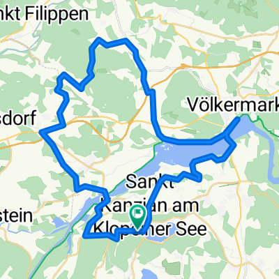
Cycling Route in Eberndorf, Carinthia, Austria

Seeberg-Schaidsattel Tour

0
Open this route in the Bikemap app

Open this route in the Bikemap app

Open this route in Bikemap Web

Open this route in Bikemap Web

93 km
Distance
1464 m
Ascent
1451 m
Descent
-:-- h
Duration
-- km/h
Avg. Speed
--- m
Max. Elevation

About This Route

Schöne Bergetappe mit zwei völlig unterschiedlichen Anstiegen. Von Klopein kann man bis nach Bad Eisenkappel auch den Radweg benutzen. In Bad Eisenkappel beginnt der 15 km lange Anstieg hinauf zum Seebergsattel (1.200 m). Der Anstieg ist sehr gleichmäßig, es gibt keine Rampen und man kann immer auf Zug fahren. Anders ist der zweite Anstieg hinauf zum Schaidasattel (1.069 m). Er ist ca. 4,5 km lang, hat eine durchschnittliche Steigung von 12 % und ist vor allem am Beginn sehr steil. Am Schaidasattel wird man dafür mit einem tollen Ausblick auf die Karawanken belohnt. Der erste Teil der Abfahrt ist neu asphaltiert. Kommt man dann auf die Landesstrasse, ist diese sehr schlecht und man muß sehr langsam fahren. Nach dem Freibacher Stausee ist der Belag wieder besser und eine rasante Abfahrt von Abtei bis nach Gallizien folgt.

This cycling route is ideal for: Road bike

You will cycle on the following surfaces: Paved

Customize this cycling route with the Bikemap route planner.

Make it yours!

Did you know? You can use this route as a template in our cycling route planner if you don't wish to start from scratch. Customize it based on your needs to plan your perfect cycling tour.

Open it in the app