Premium Badge Download on the App Store Get it on Google Play Turn-by-turn Navigation Offline Maps Bike Type Optimized Routing Premium Maps Custom Bike Computer Export Routes Route Previews Fall Detection Premium Support

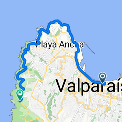
Cycling Route in Valparaíso, Región de Valparaíso, Chile

El Pajonal

0
Open this route in the Bikemap app

Open this route in the Bikemap app

Open this route in Bikemap Web

Open this route in Bikemap Web

4 km
Distance
198 m
Ascent
198 m
Descent
-:-- h
Duration
-- km/h
Avg. Speed
--- m
Max. Elevation

About This Route

Ruta patrimonial por parte del Almendral y cerro La Virgen en Valparaíso.

Recomendable subir por Santa Elena y bajar por Linares.

El acceso al camino Fundo El Pajonal esta por el costado Sur de la fábrica COSTA.

La mitad del recorrido es tierra, camino sinuoso de suave pendiente, bien compactado. El camino esta rodeado de viejos eucaliptus, hay miradores naturales con vistas hacia el plan.

La otra mitad es asfalto descendiendo a gran velocidad por el cerro la Virgen hacia calle Hontaneda.

Es una muy bonita ruta que pasa por el Valparaíso original, solo naturaleza, cerros, bosques y quebradas; el patrimonio industrial y su urbanización; el Valparaíso de los volantínes y las canchas de tierra; las particulares calles laberínticas con pendientes que hacen volar las bicicletas.

Tiempo aproximado a velocidad media (sin mucho esfuerzo) 13-14 minutos. para quienes le gusta quemar piernas estimo que fácilmente se podría hacer en 10 minutos.

This cycling route is ideal for: MTB

You will cycle on the following surfaces: Paved Unpaved

Customize this cycling route with the Bikemap route planner.

Make it yours!

Did you know? You can use this route as a template in our cycling route planner if you don't wish to start from scratch. Customize it based on your needs to plan your perfect cycling tour.

Open it in the app