Premium Badge Download on the App Store Get it on Google Play Turn-by-turn Navigation Offline Maps Bike Type Optimized Routing Premium Maps Custom Bike Computer Export Routes Route Previews Fall Detection Premium Support

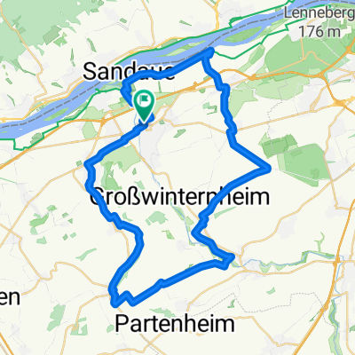
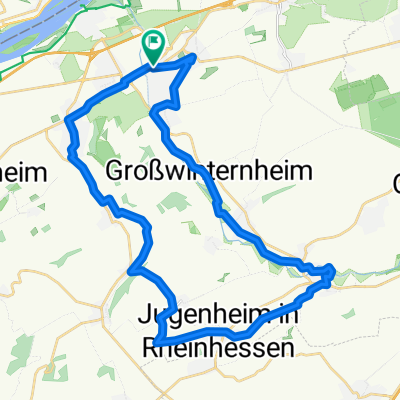
Cycling Route in Ingelheim am Rhein, Rhineland-Palatinate, Germany

Rundtour Ingelheim, Bibelnheim, Saulheim, St - Elsheim, Schwabenheim, Ingelheim

1
Open this route in the Bikemap app

Open this route in the Bikemap app

Open this route in Bikemap Web

Open this route in Bikemap Web

66 km
Distance
442 m
Ascent
398 m
Descent
-:-- h
Duration
-- km/h
Avg. Speed
260 m
Max. Elevation

About This Route

Ing., G.-Algesheim, Appenhm., N. Hilbershm., Ob.Hilbershm., Sender, Wörrstadt, Spieshm., Biebelnhm., Gabshm., Schornshm., Undenhm., Saulhm., Pardenhm., Stadecken E., Schwabenhm., G. Winternhm., Ing.


Sehr abwechslungsreiche Tour durch das "Rheinhessische Hügelland". max. Steigung 12%*, max. Gefälle 13%*. 570 HM* (*barometrische gemessen) Wieso der Routenplaner, bei einem Rundkurs, bei der Berechnung der HM in umgekehrter Fahrtrichtung auf eine andere HM - Angabe kommt, wird wohl sein Geheimnis bleiben.

This cycling route is ideal for: Road bike

You will cycle on the following surfaces: Paved

Customize this cycling route with the Bikemap route planner.

Make it yours!

Did you know? You can use this route as a template in our cycling route planner if you don't wish to start from scratch. Customize it based on your needs to plan your perfect cycling tour.

Open it in the app