

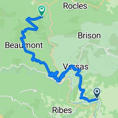
rit 8 : 123km
A cycling route starting in Joyeuse, Auvergne-Rhône-Alpes, France.
Overview
About this route
heuvelachtig
col de l'ancise
col du peras
col de charnavas
- -:--
- Duration
- 123.4 km
- Distance
- 1,321 m
- Ascent
- 1,313 m
- Descent
- ---
- Avg. speed
- ---
- Max. altitude
Route quality
Waytypes & surfaces along the route
Waytypes
Road
71.6 km
(58 %)
Quiet road
9.9 km
(8 %)
Surfaces
Paved
54.3 km
(44 %)
Asphalt
54.3 km
(44 %)
Undefined
69.1 km
(56 %)
Continue with Bikemap
Use, edit, or download this cycling route
You would like to ride rit 8 : 123km or customize it for your own trip? Here is what you can do with this Bikemap route:
Free features
- Save this route as favorite or in collections
- Copy & plan your own version of this route
- Split it into stages to create a multi-day tour
- Sync your route with Garmin or Wahoo
Premium features
Free trial for 3 days, or one-time payment. More about Bikemap Premium.
- Navigate this route on iOS & Android
- Export a GPX / KML file of this route
- Create your custom printout (try it for free)
- Download this route for offline navigation
Discover more Premium features.
Get Bikemap PremiumFrom our community
Other popular routes starting in Joyeuse
 Route to Beaumont
- Distance
- 22.1 km
- Ascent
- 1,526 m
- Descent
- 1,233 m
- Location
- Joyeuse, Auvergne-Rhône-Alpes, France
 Joyeuse/Aubenas/Ruoms/Les Vans
- Distance
- 85.4 km
- Ascent
- 435 m
- Descent
- 451 m
- Location
- Joyeuse, Auvergne-Rhône-Alpes, France
 Joyeuse-Rosières-Gorges de la Beaume-Labeaume-Champrenard-
- Distance
- 19.9 km
- Ascent
- 231 m
- Descent
- 245 m
- Location
- Joyeuse, Auvergne-Rhône-Alpes, France
 around Escourby Campsite
- Distance
- 37.8 km
- Ascent
- 697 m
- Descent
- 675 m
- Location
- Joyeuse, Auvergne-Rhône-Alpes, France
 rit 8 : 123km
- Distance
- 123.4 km
- Ascent
- 1,321 m
- Descent
- 1,313 m
- Location
- Joyeuse, Auvergne-Rhône-Alpes, France
 ardeche 1
- Distance
- 89 km
- Ascent
- 1,278 m
- Descent
- 1,279 m
- Location
- Joyeuse, Auvergne-Rhône-Alpes, France
 Joyeuse/Ruoms/Uzer/Balazuc/Vallon/Chanadolas
- Distance
- 82.8 km
- Ascent
- 585 m
- Descent
- 613 m
- Location
- Joyeuse, Auvergne-Rhône-Alpes, France
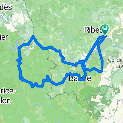
 rit 9
rit 9- Distance
- 137.6 km
- Ascent
- 1,805 m
- Descent
- 1,814 m
- Location
- Joyeuse, Auvergne-Rhône-Alpes, France
Open it in the app