Premium Badge Download on the App Store Get it on Google Play Turn-by-turn Navigation Offline Maps Bike Type Optimized Routing Premium Maps Custom Bike Computer Export Routes Route Previews Fall Detection Premium Support

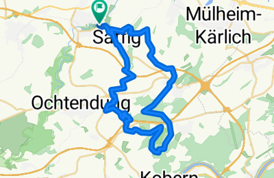
Cycling Route in Plaidt, Rhineland-Palatinate, Germany

Trainigsrunde nach getaner Arbeit CLONED FROM ROUTE 553433

2
Open this route in the Bikemap app

Open this route in the Bikemap app

Open this route in Bikemap Web

Open this route in Bikemap Web

28 km
Distance
419 m
Ascent
419 m
Descent
-:-- h
Duration
-- km/h
Avg. Speed
--- m
Max. Elevation

About This Route

Schöne Runde mit teils steilen aber kurzen Anstiegen. Fahrtechnisch auch für Anfänger geeignet. Zeitaufwand ca. 2 Std. Die Summe der Höhenmeter ist allerdings etwas niedrig. Magic Maps spuckt 450 Hm aus.

This cycling route is ideal for: MTB

You will cycle on the following surfaces: Unpaved Gravel

Customize this cycling route with the Bikemap route planner.

Make it yours!

Did you know? You can use this route as a template in our cycling route planner if you don't wish to start from scratch. Customize it based on your needs to plan your perfect cycling tour.

Open it in the app