

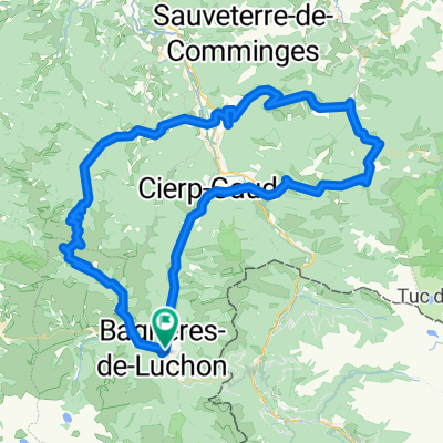
2012-09---rundtour col d'ares+ col de mente
A cycling route starting in Bagnères-de-Luchon, Occitanie, France.
Overview
About this route
Loop tour on asphalt. Cierp-Gaud – Fortignan-de-Comminges – Col d'Ares – Juzet – Col de Mente – Saint-Béat – Cierp-Gaud
- -:--
- Duration
- 63.3 km
- Distance
- 1,330 m
- Ascent
- 1,331 m
- Descent
- ---
- Avg. speed
- ---
- Max. altitude
Route quality
Waytypes & surfaces along the route
Waytypes
Road
8.9 km
(14 %)
Quiet road
5.7 km
(9 %)
Undefined
48.8 km
(77 %)
Surfaces
Paved
34.8 km
(55 %)
Asphalt
34.8 km
(55 %)
Undefined
28.5 km
(45 %)
Route highlights
Points of interest along the route
Point of interest after 12.9 km
col d'ares
Point of interest after 47.4 km
col de mente
Continue with Bikemap
Use, edit, or download this cycling route
You would like to ride 2012-09---rundtour col d'ares+ col de mente or customize it for your own trip? Here is what you can do with this Bikemap route:
Free features
- Save this route as favorite or in collections
- Copy & plan your own version of this route
- Sync your route with Garmin or Wahoo
Premium features
Free trial for 3 days, or one-time payment. More about Bikemap Premium.
- Navigate this route on iOS & Android
- Export a GPX / KML file of this route
- Create your custom printout (try it for free)
- Download this route for offline navigation
Discover more Premium features.
Get Bikemap PremiumFrom our community
Other popular routes starting in Bagnères-de-Luchon
 20180622 LUCHON BAYONNE
- Distance
- 321.4 km
- Ascent
- 4,211 m
- Descent
- 4,835 m
- Location
- Bagnères-de-Luchon, Occitanie, France
 Bagnères-de-Luchon - Tarascon-sur-Ariège 2
- Distance
- 197.9 km
- Ascent
- 4,111 m
- Descent
- 4,268 m
- Location
- Bagnères-de-Luchon, Occitanie, France
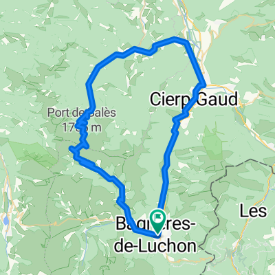
 Bales - Mente - Ares
- Distance
- 115.2 km
- Ascent
- 4,824 m
- Descent
- 4,822 m
- Location
- Bagnères-de-Luchon, Occitanie, France
 2012-09---rundtour luchon - mauleon-barousse - port de balès - luchon
- Distance
- 73 km
- Ascent
- 1,308 m
- Descent
- 1,308 m
- Location
- Bagnères-de-Luchon, Occitanie, France
 Bales
Bales- Distance
- 68.6 km
- Ascent
- 2,566 m
- Descent
- 2,566 m
- Location
- Bagnères-de-Luchon, Occitanie, France
 2012-09---rundtour col d'ares+ col de mente
- Distance
- 63.3 km
- Ascent
- 1,330 m
- Descent
- 1,331 m
- Location
- Bagnères-de-Luchon, Occitanie, France
 1ª Etapa Pirineos 2015 - Peyresourde, Aspin, Tourmalet.
- Distance
- 99.7 km
- Ascent
- 2,945 m
- Descent
- 2,865 m
- Location
- Bagnères-de-Luchon, Occitanie, France
 Le Tour De France: Stage 18
- Distance
- 148 km
- Ascent
- 3,963 m
- Descent
- 2,394 m
- Location
- Bagnères-de-Luchon, Occitanie, France
Open it in the app