Premium Badge Download on the App Store Get it on Google Play Turn-by-turn Navigation Offline Maps Bike Type Optimized Routing Premium Maps Custom Bike Computer Export Routes Route Previews Fall Detection Premium Support

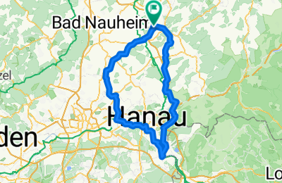
Cycling Route in Ranstadt, Hesse, Germany

Die etwas größere Tour....

0
Open this route in the Bikemap app

Open this route in the Bikemap app

Open this route in Bikemap Web

Open this route in Bikemap Web

109 km
Distance
351 m
Ascent
351 m
Descent
-:-- h
Duration
-- km/h
Avg. Speed
--- m
Max. Elevation

About This Route

Start in Dauernheim den R4 und den Niddaradweg entlang bis Bad Vilbel Gronau, weiter nach Niderdorffelden hoch zur Hohenstrasse, diese gequert und den R4 abwärts bis zur Mainfähre nach OF-Rumpenheim.

Durch Mühlheim, Steinheim wider runter zum Main bis Seligenstadt.

Dort ein Eis beim Eis-Kaiser, muß sein.

Über den Main und Mainabwärts bis Großkrotzenburg, weiter durch die Bulau nach Niederrodenbach und Langenselbold.

Dann der A45 entlang über Hammersbach, Langen-Bergheim, Hainchen, Linheim bach Glauburg-Stockheim.

Von Effolderbach eine Station 2,4 km mit der Bahn bis Ranstadt, der Zug kam gerade, dann den Berg wieder hoch wieder zum Startpunkt.

You will cycle on the following surfaces: Paved Unpaved Gravel

Customize this cycling route with the Bikemap route planner.

Make it yours!

Did you know? You can use this route as a template in our cycling route planner if you don't wish to start from scratch. Customize it based on your needs to plan your perfect cycling tour.

Open it in the app