Premium Badge Download on the App Store Get it on Google Play Turn-by-turn Navigation Offline Maps Bike Type Optimized Routing Premium Maps Custom Bike Computer Export Routes Route Previews Fall Detection Premium Support

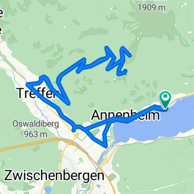
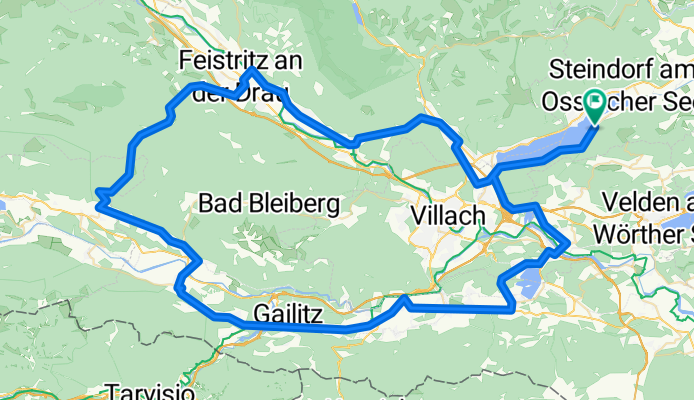
Cycling Route in Ossiach, Carinthia, Austria

TdK 3. Windische Höhe

0
Open this route in the Bikemap app

Open this route in the Bikemap app

Open this route in Bikemap Web

Open this route in Bikemap Web

114 km
Distance
1034 m
Ascent
1034 m
Descent
-:-- h
Duration
-- km/h
Avg. Speed
--- m
Max. Elevation

About This Route

Der erste Berg-Höhepunkt mit einem echten Pass! Die Windische Höhe bietet bis zu 16% Steigung; nach einer rasanten Abfahrt geht es dann auf einer landschaftlich wunderschönen Höhenstrasse in Richtung Bad Bleiberg. In Nötsch wenden wir uns nach Süden und fahren unterhalb der Karawanken am Faaker See vorbei. Somit können wir Villach, die zweitgrößte Stadt in Kärnten "links" liegen lassen.

This cycling route is ideal for: Road bike

You will cycle on the following surfaces: Paved

Customize this cycling route with the Bikemap route planner.

Make it yours!

Did you know? You can use this route as a template in our cycling route planner if you don't wish to start from scratch. Customize it based on your needs to plan your perfect cycling tour.

Open it in the app