Premium Badge Download on the App Store Get it on Google Play Turn-by-turn Navigation Offline Maps Bike Type Optimized Routing Premium Maps Custom Bike Computer Export Routes Route Previews Fall Detection Premium Support

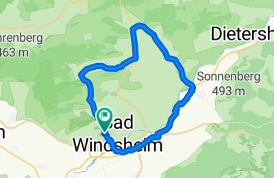
Cycling Route in Bad Windsheim, Bavaria, Germany

2024-12-12_In den Tiefgrund und Aischgrund knapp über dem Gefrierpunkt

0
Open this route in the Bikemap app

Open this route in the Bikemap app

Open this route in Bikemap Web

Open this route in Bikemap Web

25 km
Distance
144 m
Ascent
193 m
Descent
1:29 h
Duration
19.3 km/h
Avg. Speed
367 m
Max. Elevation

About This Route

Bad Windsheim-Unterntief: Straße wenig Verkehr, Unterntief-Berolzheim: geteerter Flurweg, Berolzheim-Rüdisbronn: neuer Radweg, Rüdisbronn-Kaubenheim: Wenig Eerkehr Ortsverbindungsstraße. Kaubenheim-Ipsheim: Radweg, In Ipsheim: Seitenstraßen und B470( Für Familien ungeeignet) Ipsheim Oberndorf Radweg, in Oberndorf auf B470 oder auf wenig geeinetern Wiesenweg entlang des Flutgrabens, Nach Oberndorf-Lenkersheim: Radweg, Lenkersheim-Bad Windsheim: Entlang B470 und Freilandmuseum BW mit Überquerung der Zufahrt von B470 nach BAd Windsheim.

This cycling route is ideal for: MTB City bike

Customize this cycling route with the Bikemap route planner.

Make it yours!

Did you know? You can use this route as a template in our cycling route planner if you don't wish to start from scratch. Customize it based on your needs to plan your perfect cycling tour.

Open it in the app