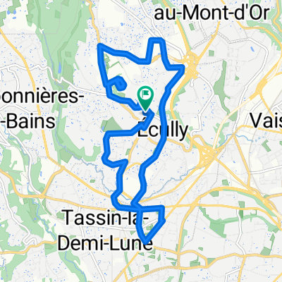
Premium Badge Download on the App Store Get it on Google Play Turn-by-turn Navigation Offline Maps Bike Type Optimized Routing Premium Maps Custom Bike Computer Export Routes Route Previews Fall Detection Premium Support

Cycling Route in 脡cully, Auvergne-Rh么ne-Alpes, France

Theiz茅 par Lachassagne

1
Open this route in the Bikemap app

Open this route in the Bikemap app

Open this route in Bikemap Web

Open this route in Bikemap Web

70 km
Distance
1026 m
Ascent
1026 m
Descent
-:-- h
Duration
-- km/h
Avg. Speed
--- m
Max. Elevation

About This Route

Joli parcours vallonn茅 dans le beaujolais. Les principales difficult茅s de la sortie sont la c么te de Lachassagne (au d茅part de Anse) et le col du Mont Thou (au d茅part de Curis). La derni猫re c么te (celle du col du Mont Thou) peut 锚tre difficile en fin de parcours. Elle est l'une des plus relev茅e de la proche r茅gion lyonnaise.聽Le parcours est, dans l'ensemble, peu fr茅quent茅 par les voitures.

This cycling route is ideal for: Road bike

You will cycle on the following surfaces: Unpaved

Customize this cycling route with the Bikemap route planner.

Make it yours!

Did you know? You can use this route as a template in our cycling route planner if you don't wish to start from scratch. Customize it based on your needs to plan your perfect cycling tour.

Open it in the app