Premium Badge Download on the App Store Get it on Google Play Turn-by-turn Navigation Offline Maps Bike Type Optimized Routing Premium Maps Custom Bike Computer Export Routes Route Previews Fall Detection Premium Support

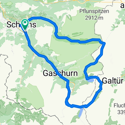
Cycling Route in Schruns, Vorarlberg, Austria

Montafon Mountainbike Marathon M2 - anspruchsvoll CLONED FROM ROUTE 909572

1
Open this route in the Bikemap app

Open this route in the Bikemap app

Open this route in Bikemap Web

Open this route in Bikemap Web

61 km
Distance
2106 m
Ascent
2106 m
Descent
-:-- h
Duration
-- km/h
Avg. Speed
--- m
Max. Elevation

About This Route

Durch Waldgebiete führt die Strecke ins Hochmoor Wildried Silbertal, dann über den Kristberg vorbei an den Tora-, Fula- und Fritzenseen zum Fuße des Itonskopf. Ein weiterer Höhepunkt wird dann der Abschnitt nach dem Rellseck. Über den Bartholomäberg führt ein anspruchsvoller, steiler, sehr exponierter und schmaler Single-Trail durch den Gaueser Wald, vorbei am Kloster Gauenstein bis nach Gantschier. Das Finale wird über den dritten großen Anstieg der Strecke auf dem Weg ins Rätikon eingeleitet.


Schruns – Silbertal – Kristberg – Rellseck – Bartholomäberg – Gantschier – Vadans – Matschwitz – Latschau – Bitschweil – Schruns

This cycling route is ideal for: MTB

You will cycle on the following surfaces: Paved Unpaved Gravel

Customize this cycling route with the Bikemap route planner.

Make it yours!

Did you know? You can use this route as a template in our cycling route planner if you don't wish to start from scratch. Customize it based on your needs to plan your perfect cycling tour.

Open it in the app