Premium Badge Download on the App Store Get it on Google Play Turn-by-turn Navigation Offline Maps Bike Type Optimized Routing Premium Maps Custom Bike Computer Export Routes Route Previews Fall Detection Premium Support

Cycling Route in Niederalteich, Bavaria, Germany

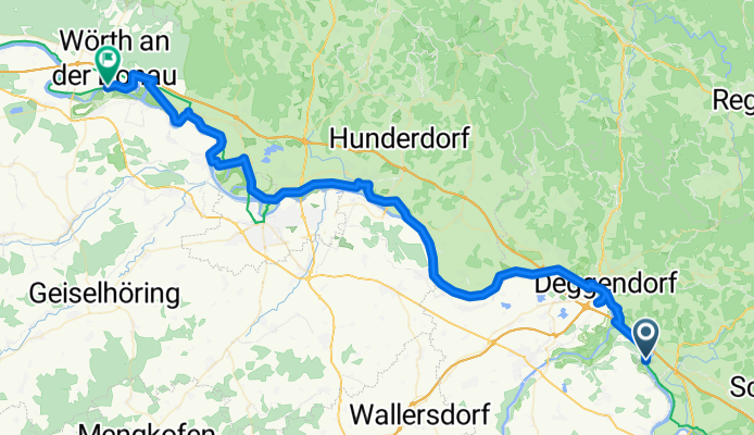
2012 Niederaltteich-Wörth/Donau
1
Open this route in Bikemap Web

Open this route in Bikemap Web

72 km
Distance
98 m
Ascent
87 m
Descent
-:-- h
Duration
-- km/h
Avg. Speed
--- m
Max. Elevation

About This Route

Ein wirklich Ödes Stück

besonders bei 36Grad im Schatten

es gibt KEINEN  schatten auf den ganzen 79 km

ätzend

Nur mais und ab und zu der Fluß

brauch kein mensch den Abschnitt!

Im Schatten von 13:00 bis 19:00 weil ansonsten bei 55 Grad in der Sonne Radfahren schwachsinnig wird

You will cycle on the following surfaces: Paved

Highlights Along The Route

Point of Interest

laaaaange Pause bei 36 Grad im Schatten neben Kirche Wasser auf friedhof,gaststätte mit NIX los 50m weiter

Point of Interest

Ü Platz Schleuse

Customize this cycling route with the Bikemap route planner.

Make it yours!

You can use this route as a template in our cycling route planner so that you don’t have to start from scratch. Customize it based on your needs to plan your perfect cycling tour.