Premium Badge Download on the App Store Get it on Google Play Turn-by-turn Navigation Offline Maps Bike Type Optimized Routing Premium Maps Custom Bike Computer Export Routes Route Previews Fall Detection Premium Support

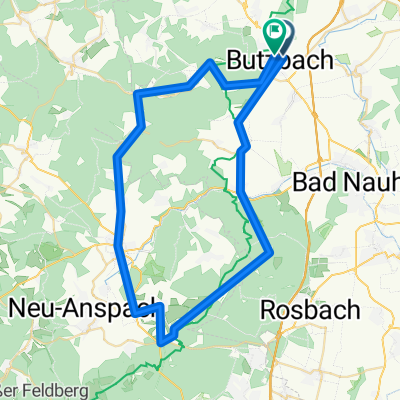
Cycling Route in Butzbach, Hesse, Germany

Durch das Göns ins Kleebachtal

1
Open this route in the Bikemap app

Open this route in the Bikemap app

Open this route in Bikemap Web

Open this route in Bikemap Web

38 km
Distance
351 m
Ascent
351 m
Descent
-:-- h
Duration
-- km/h
Avg. Speed
--- m
Max. Elevation

About This Route

Die Strecke führt von Butzbach durch den Griedeler Wald nach Langgöns. Richtung Dornholzhausen nach Niederkleen, weiter nach Oberkleen und Cleeberg. Von hier geht es in Richtung Espa über das Butzbacher Forsthaus am Segelflugplatz vorbei zurück nach Butzbach. 

Was gibt es zu sehen:

Marktplatz Butzbach, Limes, Postverteilzentrum, Fachwerkhäuser in Niederkleen, Burg Cleeberg, Segelflugplatz, Forsthaus von Butzbach Römerturm und Weidig Denkmal.

Einkehrmöglichkeiten sin ausreichend vorhanden.


You will cycle on the following surfaces: Paved Gravel

Customize this cycling route with the Bikemap route planner.

Make it yours!

Did you know? You can use this route as a template in our cycling route planner if you don't wish to start from scratch. Customize it based on your needs to plan your perfect cycling tour.

Open it in the app