

Langenhain - Atzelberg - Billtal - Langenhain
A cycling route starting in Hofheim am Taunus, Hesse, Germany.
Overview
About this route
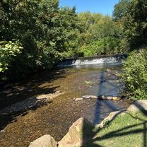
From Langenhain, it goes via Eppstein and from there below Staufen to Fischbach. From there to Eppenhain and to the Atzelbergturm. Now another round around Eppenhain and then to Billtalhöhe. Now we take the Kramerweg downhill to Ehlhalten. From there, the main road up towards Oberjosbach. (The forest path was not passable) At the top, just before Oberjosbach, then at the parking lot into the forest, and then to Hof Häusel. Now the asphalt road to the main road, a bit along the main road towards Eppstein, and then back to Langenhain through the Amsteltal.
- -:--
- Duration
- 52.7 km
- Distance
- 979 m
- Ascent
- 999 m
- Descent
- ---
- Avg. speed
- 541 m
- Max. altitude
Route quality
Waytypes & surfaces along the route
Waytypes
Track
31.1 km
(59 %)
Quiet road
10.5 km
(20 %)
Surfaces
Paved
16.9 km
(32 %)
Unpaved
27.4 km
(52 %)
Gravel
19 km
(36 %)
Asphalt
15.3 km
(29 %)
Continue with Bikemap
Use, edit, or download this cycling route
You would like to ride Langenhain - Atzelberg - Billtal - Langenhain or customize it for your own trip? Here is what you can do with this Bikemap route:
Free features
- Save this route as favorite or in collections
- Copy & plan your own version of this route
- Sync your route with Garmin or Wahoo
Premium features
Free trial for 3 days, or one-time payment. More about Bikemap Premium.
- Navigate this route on iOS & Android
- Export a GPX / KML file of this route
- Create your custom printout (try it for free)
- Download this route for offline navigation
Discover more Premium features.
Get Bikemap PremiumFrom our community
Other popular routes starting in Hofheim am Taunus
 Iltisweg, Hofheim am Taunus nach Iltisweg, Hofheim am Taunus
- Distance
- 60 km
- Ascent
- 322 m
- Descent
- 322 m
- Location
- Hofheim am Taunus, Hesse, Germany
 Narturpark
- Distance
- 33.4 km
- Ascent
- 364 m
- Descent
- 380 m
- Location
- Hofheim am Taunus, Hesse, Germany
 lghn-kaisertempel-meisterturm
- Distance
- 27.8 km
- Ascent
- 726 m
- Descent
- 726 m
- Location
- Hofheim am Taunus, Hesse, Germany
 Iltisweg, Hofheim am Taunus nach Iltisweg, Hofheim am Taunus
- Distance
- 32.1 km
- Ascent
- 539 m
- Descent
- 540 m
- Location
- Hofheim am Taunus, Hesse, Germany
 Langenhain - Atzelberg - Billtal - Langenhain
- Distance
- 52.7 km
- Ascent
- 979 m
- Descent
- 999 m
- Location
- Hofheim am Taunus, Hesse, Germany
 Hofheim bis fast Königstein
- Distance
- 34.8 km
- Ascent
- 719 m
- Descent
- 682 m
- Location
- Hofheim am Taunus, Hesse, Germany
 Einfache Fahrt in Hofheim am Taunus
- Distance
- 19.7 km
- Ascent
- 488 m
- Descent
- 489 m
- Location
- Hofheim am Taunus, Hesse, Germany
 Hofheim-Flughafen 40km
- Distance
- 39.9 km
- Ascent
- 126 m
- Descent
- 126 m
- Location
- Hofheim am Taunus, Hesse, Germany
Open it in the app