Premium Badge Download on the App Store Get it on Google Play Turn-by-turn Navigation Offline Maps Bike Type Optimized Routing Premium Maps Custom Bike Computer Export Routes Route Previews Fall Detection Premium Support

Cycling Route in Haar, Bavaria, Germany

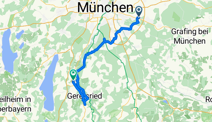
13.05.18 Königsdorfer Alm

0
Open this route in the Bikemap app

Open this route in the Bikemap app

Open this route in Bikemap Web

Open this route in Bikemap Web

64 km
Distance
197 m
Ascent
159 m
Descent
-:-- h
Duration
-- km/h
Avg. Speed
--- m
Max. Elevation

About This Route

Vom S-Bahnhof Haar auf dem südlichen Teil des Münchner Radlringes bis Deisenhofen und weiter über Straßlach ins Isartal Richtung Königsdorf. Zürück bis Wolfratshausen und mit der S-Bahn wieder heim.

You will cycle on the following surfaces: Paved Unpaved Gravel

Customize this cycling route with the Bikemap route planner.

Make it yours!

Did you know? You can use this route as a template in our cycling route planner if you don't wish to start from scratch. Customize it based on your needs to plan your perfect cycling tour.

Open it in the app