Premium Badge Download on the App Store Get it on Google Play Turn-by-turn Navigation Offline Maps Bike Type Optimized Routing Premium Maps Custom Bike Computer Export Routes Route Previews Fall Detection Premium Support

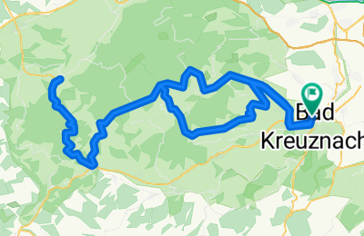
Cycling Route in Bad Kreuznach, Rhineland-Palatinate, Germany

Peter & Christian 2009

0
Open this route in the Bikemap app

Open this route in the Bikemap app

Open this route in Bikemap Web

Open this route in Bikemap Web

119 km
Distance
2175 m
Ascent
2141 m
Descent
-:-- h
Duration
-- km/h
Avg. Speed
425 m
Max. Elevation

About This Route

KH - Hargesheim - Gräfenbachtal bis Wallhausen - über den Hügel nach St. Katharinen - über die Rampe nach Mandel - Sponheim - Bockenau - Ellerbachtal bis Kreershäuschen - an Seesebach vorbei geniale Abfahrt nach Simmertal - durch's Kellenbachtal bis zur Tankstelle in Gemünden.

Cola reinhauen und zurück :-)

Achtung: die genial Abfahrt wird jetzt zur anspruchsvollen Steigung ;-)

Ab Münchwald (2. geniale Abfahrt!) durch's Gräfenbachtal zurück nach KH

This cycling route is ideal for: Road bike

You will cycle on the following surfaces: Paved

Customize this cycling route with the Bikemap route planner.

Make it yours!

Did you know? You can use this route as a template in our cycling route planner if you don't wish to start from scratch. Customize it based on your needs to plan your perfect cycling tour.

Open it in the app