Premium Badge Download on the App Store Get it on Google Play Turn-by-turn Navigation Offline Maps Bike Type Optimized Routing Premium Maps Custom Bike Computer Export Routes Route Previews Fall Detection Premium Support

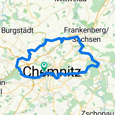
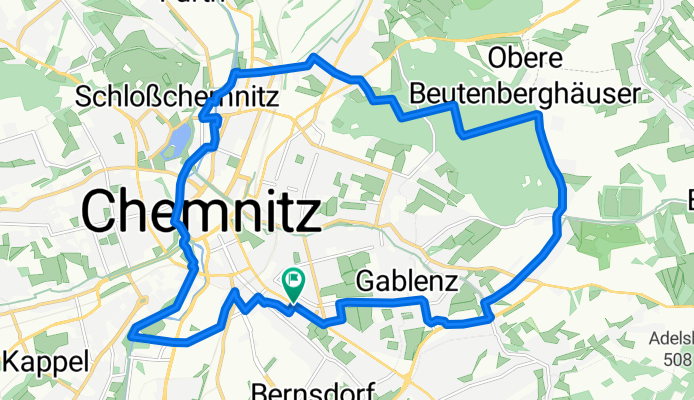
Cycling Route in Chemnitz, Saxony, Germany

kleine Tour um Chemnitz

2
Open this route in the Bikemap app

Open this route in the Bikemap app

Open this route in Bikemap Web

Open this route in Bikemap Web

20 km
Distance
136 m
Ascent
158 m
Descent
-:-- h
Duration
-- km/h
Avg. Speed
400 m
Max. Elevation

About This Route

Auf der Carl-von-Ossietzky-Straße geht es raus aus Chemnitz und kurz entlang des Südrings. Ab da kann man der Ausschilderung der SO-Route um Chemnitz folgen: Weißer Weg (von hier hat man einen schönen Blick über Euba), durch den Zeisigwald und über die Dresdner Straße. Dann verlassen wir die SO-Route und folgen dem Zschopauetalradweg, bzw. der Chemnitz bis zum Falkeplatz. Hier geht es dann vorbei an der Feuerwache und über den Südring in den Stadtpark. Zurück fahren wir auf der Altchemnitzer Straße, über die Reichenhainer Straße und Bernsdorfer Straße und durch den Rosenplatz.

You will cycle on the following surfaces: Paved Unpaved

Customize this cycling route with the Bikemap route planner.

Make it yours!

Did you know? You can use this route as a template in our cycling route planner if you don't wish to start from scratch. Customize it based on your needs to plan your perfect cycling tour.

Open it in the app