Premium Badge Download on the App Store Get it on Google Play Turn-by-turn Navigation Offline Maps Bike Type Optimized Routing Premium Maps Custom Bike Computer Export Routes Route Previews Fall Detection Premium Support

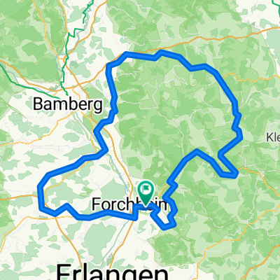
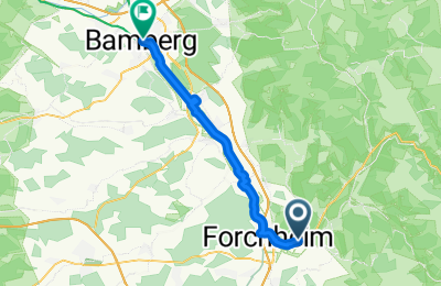
Cycling Route in Pinzberg, Bavaria, Germany

Forchheim - Bamberg am Kanal

0
Open this route in the Bikemap app

Open this route in the Bikemap app

Open this route in Bikemap Web

Open this route in Bikemap Web

30 km
Distance
40 m
Ascent
78 m
Descent
-:-- h
Duration
-- km/h
Avg. Speed
288 m
Max. Elevation

About This Route

Schöne Strecke.

Die gefahrene und gezeichnete Strecke ist jetzt eher was für ein Tourenrad bzw. Mountainbike. Aber die in der Regel mehr oder weniger parallel verlaufenden Straßen machen die Strecke grundsätzlich auch rennrad-tauglich.

Bei Strullendorf muß man an der Schleuse wirklich diesen komischen Zacken durch das Industriegebiet reinfahren. Die Unterführung unter der Brücke gehört zum Schleusengelände und ist durch Zäune und Tore abgegrenzt.

This cycling route is ideal for: Road bike MTB

You will cycle on the following surfaces: Paved Gravel

Customize this cycling route with the Bikemap route planner.

Make it yours!

Did you know? You can use this route as a template in our cycling route planner if you don't wish to start from scratch. Customize it based on your needs to plan your perfect cycling tour.

Open it in the app