Premium Badge Download on the App Store Get it on Google Play Turn-by-turn Navigation Offline Maps Bike Type Optimized Routing Premium Maps Custom Bike Computer Export Routes Route Previews Fall Detection Premium Support

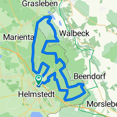
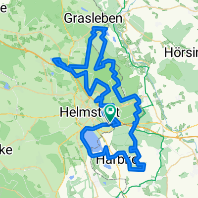
Cycling Route in Helmstedt, Lower Saxony, Germany

Helmstedt - Naturschutzgebiet Lappwald

1
Open this route in the Bikemap app

Open this route in the Bikemap app

Open this route in Bikemap Web

Open this route in Bikemap Web

20 km
Distance
250 m
Ascent
225 m
Descent
-:-- h
Duration
-- km/h
Avg. Speed
--- m
Max. Elevation

About This Route

Die Tour beginnt am Strohmühlenteich und geht durch den Wald nach Bad Helmstedt. Nach Umrundung der beiden Teiche geht es zum Birkerteich. Zum Abschluß gibt es eine Runde durch da Naturschutzgebiet Lappwald und zurück nach Helmstedt.

This cycling route is ideal for: MTB

You will cycle on the following surfaces: Paved Unpaved Gravel

Customize this cycling route with the Bikemap route planner.

Make it yours!

Did you know? You can use this route as a template in our cycling route planner if you don't wish to start from scratch. Customize it based on your needs to plan your perfect cycling tour.

Open it in the app