Premium Badge Download on the App Store Get it on Google Play Turn-by-turn Navigation Offline Maps Bike Type Optimized Routing Premium Maps Custom Bike Computer Export Routes Route Previews Fall Detection Premium Support

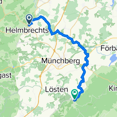
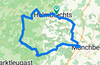
Cycling Route in Helmbrechts, Bavaria, Germany

Auf ruhigen Straßen

1
Open this route in the Bikemap app

Open this route in the Bikemap app

Open this route in Bikemap Web

Open this route in Bikemap Web

31 km
Distance
355 m
Ascent
356 m
Descent
-:-- h
Duration
-- km/h
Avg. Speed
--- m
Max. Elevation

About This Route

Eine klassische und entspannte Runde über ruhige Straßen und beschauliche Örtchen. Highlight der Strecke ist das schnelle Teilstück durch Rappetenreuth bis Hohenberg. Dort geht es rechts in die Ortschaft und danach links nach Sauerhof durch eine kleine Steigung. Danach folgt ein weiteres recht ebenes Teilstück vorbei an Schödlas, Pulschnitz und Poppenreuth. Danach folgt eine langgezogene leichte Anhöhe bis zur Kreuzung aus Unfriedsdorf. Man kann von hier direkt auf den Radweg Richtung Helmbrechts, oder, wie ich, durch Maierhof, wo nach einem kleinen Berg ein schnelles Finalstück bis in die Haide wartet.

(cloned from route 1865891)

This cycling route is ideal for: Road bike

You will cycle on the following surfaces: Paved

Customize this cycling route with the Bikemap route planner.

Make it yours!

Did you know? You can use this route as a template in our cycling route planner if you don't wish to start from scratch. Customize it based on your needs to plan your perfect cycling tour.

Open it in the app