Premium Badge Download on the App Store Get it on Google Play Turn-by-turn Navigation Offline Maps Bike Type Optimized Routing Premium Maps Custom Bike Computer Export Routes Route Previews Fall Detection Premium Support

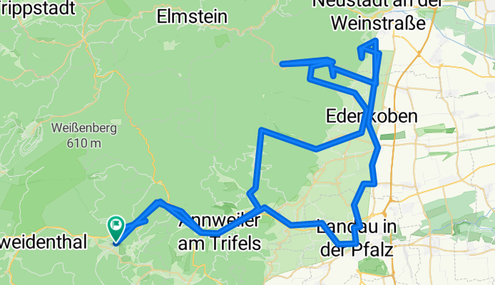
Cycling Route in Hauenstein, Rhineland-Palatinate, Germany

445. "HAMBACHER SCHLOSS/ DIE KALMIT"

0
Open this route in the Bikemap app

Open this route in the Bikemap app

Open this route in Bikemap Web

Open this route in Bikemap Web

119 km
Distance
1126 m
Ascent
1128 m
Descent
-:-- h
Duration
-- km/h
Avg. Speed
--- m
Max. Elevation

About This Route

Teil 3 der MTT "Pfälzerwald",

gefahren 30.04.2014

2 schöne Auffahrten zum Hambacher

Schloss und auf die Kalmit, höchster

Punkt [673m] im Pfälzerwald

Variante über Ramberg (3 Tn; weitere

4 Tn über Frankweiler)

(cloned from route 2589470)

This cycling route is ideal for: Road bike

You will cycle on the following surfaces: Paved

Customize this cycling route with the Bikemap route planner.

Make it yours!

Did you know? You can use this route as a template in our cycling route planner if you don't wish to start from scratch. Customize it based on your needs to plan your perfect cycling tour.

Open it in the app