Premium Badge Download on the App Store Get it on Google Play Turn-by-turn Navigation Offline Maps Bike Type Optimized Routing Premium Maps Custom Bike Computer Export Routes Route Previews Fall Detection Premium Support

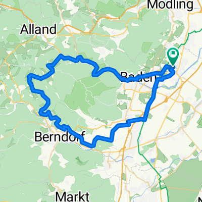
Cycling Route in Traiskirchen, Lower Austria, Austria

Thermenlandradweg-Helenentalradweg-Alland-Hafnerberg-Triestingtalradweg-Thermenlandradweg

0
Open this route in the Bikemap app

Open this route in the Bikemap app

Open this route in Bikemap Web

Open this route in Bikemap Web

69 km
Distance
346 m
Ascent
349 m
Descent
-:-- h
Duration
-- km/h
Avg. Speed
--- m
Max. Elevation

About This Route


Etwas anstrengende Route durch die vielen Höhenmeter - vor allem auf der Straße von Alland zum Triestingtalradweg. Der Helenentalradweg endet in Sattelbach, dann muss man auf der Bundesstraße weiter fahren.

ca. 68,8 km, Fahrzeit ca 5 Std.

You will cycle on the following surfaces: Paved Gravel

Customize this cycling route with the Bikemap route planner.

Make it yours!

Did you know? You can use this route as a template in our cycling route planner if you don't wish to start from scratch. Customize it based on your needs to plan your perfect cycling tour.

Open it in the app