Um den See und auf den Kogel
A cycling route starting in Maria Wörth, Carinthia, Austria.
Overview
About this route
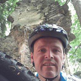
Starting from Pörtschach, we follow the bike paths towards Velden. In Velden, we weave through Jaguars, Porsches, BMWs, Audis, and more, and after a short climb, we enter a cool forest despite the summer temperatures. Soon after, we find ourselves in the so-called 'stream bed,' which requires some technical riding skills and, especially in the last section, quite a bit of strength. After this 'technical part,' there's a short moment to dismount and lift the bikes over the fence of a horse paddock. Then we continue on comfortably rideable paths through the Schieflinger Forest. We proceed to Goritschach, passing by Trattnigteich pond, where shortly after the climb to Pyramidenkogel begins. On superb trails with stunning lake views in some spots, we ascend to Pyramidenkogel, where we take a brief break, eat energy bars, and refill water bottles before starting the descent on a section of the hiking trail that offers selective challenges in places. After a rapid descent to Keutschacher See and a leisurely ride past Rauschelesee, we reach Viktring and shortly after arrive at the Lend Canal at Südring in Klagenfurt. As the beach volleyball tournament is taking place, we follow the music and soon find ourselves right beside the arena among hundreds, or better yet thousands, of fans. After briefly enjoying the atmosphere, we pedal again and mostly ride on bike paths via Krumpendorf back to Pörtschach.
Participants: Herbert, Lassi, Franz and Richard
- -:--
- Duration
- 49.8 km
- Distance
- 721 m
- Ascent
- 681 m
- Descent
- ---
- Avg. speed
- 844 m
- Max. altitude
Route quality
Waytypes & surfaces along the route
Waytypes
Quiet road
17.4 km
(35 %)
Cycleway
16.9 km
(34 %)
Surfaces
Paved
35.8 km
(72 %)
Unpaved
7.5 km
(15 %)
Asphalt
34.3 km
(69 %)
Gravel
4.5 km
(9 %)
Continue with Bikemap
Use, edit, or download this cycling route
You would like to ride Um den See und auf den Kogel or customize it for your own trip? Here is what you can do with this Bikemap route:
Free features
- Save this route as favorite or in collections
- Copy & plan your own version of this route
- Sync your route with Garmin or Wahoo
Premium features
Free trial for 3 days, or one-time payment. More about Bikemap Premium.
- Navigate this route on iOS & Android
- Export a GPX / KML file of this route
- Create your custom printout (try it for free)
- Download this route for offline navigation
Discover more Premium features.
Get Bikemap PremiumFrom our community
Other popular routes starting in Maria Wörth
 WörtherseeRunde_43km_310hm
- Distance
- 42.1 km
- Ascent
- 244 m
- Descent
- 243 m
- Location
- Maria Wörth, Carinthia, Austria
 Ossiacher Tauern
- Distance
- 49.4 km
- Ascent
- 729 m
- Descent
- 729 m
- Location
- Maria Wörth, Carinthia, Austria
 zum Faaker -Insel
- Distance
- 22.4 km
- Ascent
- 237 m
- Descent
- 126 m
- Location
- Maria Wörth, Carinthia, Austria
 Um den See und auf den Kogel
- Distance
- 49.8 km
- Ascent
- 721 m
- Descent
- 681 m
- Location
- Maria Wörth, Carinthia, Austria
 Wörth-Hoher Galien
- Distance
- 47.7 km
- Ascent
- 798 m
- Descent
- 799 m
- Location
- Maria Wörth, Carinthia, Austria
 dokoła Worthersee
- Distance
- 41.5 km
- Ascent
- 212 m
- Descent
- 212 m
- Location
- Maria Wörth, Carinthia, Austria
 Draurunde
- Distance
- 55.2 km
- Ascent
- 365 m
- Descent
- 366 m
- Location
- Maria Wörth, Carinthia, Austria
 Mit'n Radl aufn PyramiedenKogel
- Distance
- 21.1 km
- Ascent
- 486 m
- Descent
- 119 m
- Location
- Maria Wörth, Carinthia, Austria
Open it in the app


