Premium Badge Download on the App Store Get it on Google Play Turn-by-turn Navigation Offline Maps Bike Type Optimized Routing Premium Maps Custom Bike Computer Export Routes Route Previews Fall Detection Premium Support

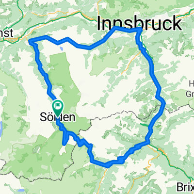
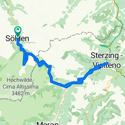
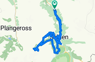
Cycling Route in Solden, Tyrol, Austria

Tiefenbachgletcher and Rettenbachgletcher from Solden

1
Open this route in the Bikemap app

Open this route in the Bikemap app

Open this route in Bikemap Web

Open this route in Bikemap Web

58 km
Distance
1870 m
Ascent
1864 m
Descent
-:-- h
Duration
-- km/h
Avg. Speed
--- m
Max. Elevation

About This Route

A route that takes you to the Tiefenbachgletcher tunnel and to Rettenbachgletcher in Solden, at 2800 m, from Camping Wingle. The route is on forest road up to 2100 m and then it descends to Hochsolden also on forrest road.

This cycling route is ideal for: MTB

You will cycle on the following surfaces: Unpaved

Customize this cycling route with the Bikemap route planner.

Make it yours!

Did you know? You can use this route as a template in our cycling route planner if you don't wish to start from scratch. Customize it based on your needs to plan your perfect cycling tour.

Open it in the app