Premium Badge Download on the App Store Get it on Google Play Turn-by-turn Navigation Offline Maps Bike Type Optimized Routing Premium Maps Custom Bike Computer Export Routes Route Previews Fall Detection Premium Support

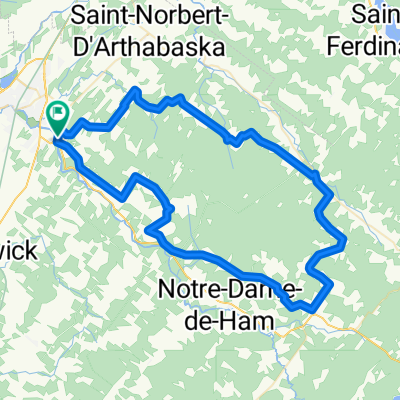
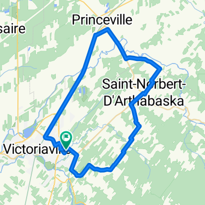
Cycling Route in Victoriaville, Quebec, Canada

Aventureux 1; jour 2

0
Open this route in the Bikemap app

Open this route in the Bikemap app

Open this route in Bikemap Web

Open this route in Bikemap Web

75 km
Distance
368 m
Ascent
367 m
Descent
-:-- h
Duration
-- km/h
Avg. Speed
--- m
Max. Elevation

About This Route

Superbe boucle dont la première partie se fait sur un terrain relativement plat et avec quelques montées sur les contreforts des Appalaches au retour. Entre la rue Pix-X et  le 4e rangt, il y a une section d'environ 1,3 km de criblure de pierre très fine et dense  qui est facile à rouler. Cependant vous pouvez emprunter la rue Gamache qui devient plus tranquille après 8h30. L'accottement sur la route 116 est trrès large.

This cycling route is ideal for: Road bike

You will cycle on the following surfaces: Paved

Highlights Along The Route

Point of Interest

Super point de vue

Point of Interest

Super point de vue sur la plaine à gauche et sur la vallée à droite.

Point of Interest

MIel Boivin, miellerie artisanale

More highlights are available with Bikemap for iOS and Android.

Customize this cycling route with the Bikemap route planner.

Make it yours!

Did you know? You can use this route as a template in our cycling route planner if you don't wish to start from scratch. Customize it based on your needs to plan your perfect cycling tour.

Open it in the app