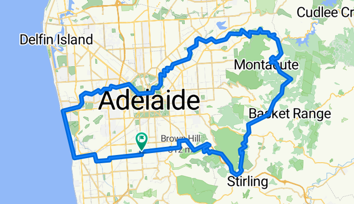
Cycling Route in Clarence Gardens, South Australia, Australia
mt lofty loop 1

Open this route in Bikemap Web
Distance
Ascent
Descent
Duration
Avg. Speed
Max. Elevation
Cycling Route in Clarence Gardens, South Australia, Australia

Open this route in Bikemap Web
This route is approximately 100km and takes in the best of the hills, Torrens linear park, and the beach.
This loop is best done in the anti-clockwise direction, as it makes use of the Adelaide-Crafers bikeway to climb up to Mt Lofty. Take a break at the Lofty summit to celebrate the climb. The rest of the ride is pretty easy.
Watch out for Corkscrew Rd coming down from Montacute Rd at Montacute to Gorge Rd at Castambul. It is VERY steep. Good breaks required. Lots of fun.
This loop has very low car traffic - over 50% is on bike path. Take care on Cross Rd at Glen Osmond and Gorge Rd at Castambul. You'll be able to get off Gorge Rd after just a couple of km as the Torrens linear park starts near there.
check connection between top of crafers bikeway and mt lofty summmit rd. sattelite maps not working.
Check bike paths in Glenelg area.

You can use this route as a template in our cycling route planner so that you don’t have to start from scratch. Customize it based on your needs to plan your perfect cycling tour.