Premium Badge Download on the App Store Get it on Google Play Turn-by-turn Navigation Offline Maps Bike Type Optimized Routing Premium Maps Custom Bike Computer Export Routes Route Previews Fall Detection Premium Support

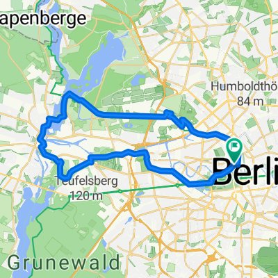
Cycling Route in Tiergarten, Land Berlin, Germany

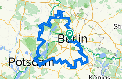
Berliner Grenzverlauf

6
Open this route in the Bikemap app

Open this route in the Bikemap app

Open this route in Bikemap Web

Open this route in Bikemap Web

160 km
Distance
188 m
Ascent
185 m
Descent
-:-- h
Duration
-- km/h
Avg. Speed
--- m
Max. Elevation

About This Route

Dies ist keine abzufahrende Strecke, sondern der exakte Grenzverlauf um Westberlin bis 1989. Die Grenzlinie ist natürlich nicht genau mit den Grenzsicherungsanlagen (z.B. der Mauer) identisch. sondern sie ist Bezirks-, Sektoren- bzw. Landesgrenze-. Im Zeitraum der "scharfen Grenze" wurden zahlreiche Flächentausche zwischen der DDR und Westberlin vorgenommen, die hier nicht im einzelnen dargestellt werden können. Auch die Exklaven sind bei diesem Grenzverlauf nicht mit enthalten.

You will cycle on the following surfaces: Unpaved

Highlights Along The Route

Point of Interest

Beginn

Customize this cycling route with the Bikemap route planner.

Make it yours!

Did you know? You can use this route as a template in our cycling route planner if you don't wish to start from scratch. Customize it based on your needs to plan your perfect cycling tour.

Open it in the app