

Cantalupo-Bofalora-Parabiago
A cycling route starting in Cantalupo, Lombardy, Italy.
Overview
About this route
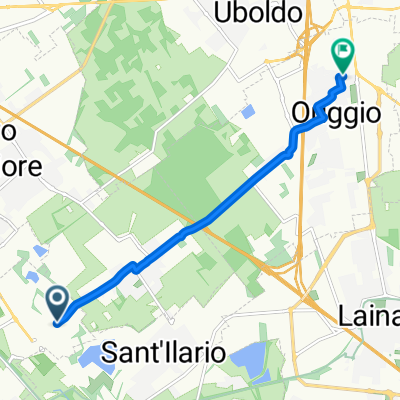
Route initially characterized by a cycle path to Boffalora Sopra Ticino, then taking provincial roads that connect from Cuggiono to Parabiago. The final stretch is along the Villoresi canal.
- -:--
- Duration
- 56.5 km
- Distance
- 63 m
- Ascent
- 63 m
- Descent
- ---
- Avg. speed
- ---
- Max. altitude
Route quality
Waytypes & surfaces along the route
Waytypes
Cycleway
20.3 km
(36 %)
Road
18.1 km
(32 %)
Surfaces
Paved
41.8 km
(74 %)
Asphalt
41.3 km
(73 %)
Paved (undefined)
0.6 km
(1 %)
Undefined
14.7 km
(26 %)
Continue with Bikemap
Use, edit, or download this cycling route
You would like to ride Cantalupo-Bofalora-Parabiago or customize it for your own trip? Here is what you can do with this Bikemap route:
Free features
- Save this route as favorite or in collections
- Copy & plan your own version of this route
- Sync your route with Garmin or Wahoo
Premium features
Free trial for 3 days, or one-time payment. More about Bikemap Premium.
- Navigate this route on iOS & Android
- Export a GPX / KML file of this route
- Create your custom printout (try it for free)
- Download this route for offline navigation
Discover more Premium features.
Get Bikemap PremiumFrom our community
Other popular routes starting in Cantalupo
 Bosco Uboldo
- Distance
- 11.7 km
- Ascent
- 27 m
- Descent
- 32 m
- Location
- Cantalupo, Lombardy, Italy
 Via Luciano Manara, Parabiago a Via Giosuè Ceriani, Origgio
- Distance
- 6.5 km
- Ascent
- 26 m
- Descent
- 13 m
- Location
- Cantalupo, Lombardy, Italy
 Da Via Risorgimento 5D, Cantalupo a Piazza Castello 4, Carimate
- Distance
- 21.9 km
- Ascent
- 160 m
- Descent
- 62 m
- Location
- Cantalupo, Lombardy, Italy
 Via Caduti della Liberazione, Uboldo nach Piazza Giacomo Matteotti 2, Cantalupo
- Distance
- 2.5 km
- Ascent
- 3 m
- Descent
- 10 m
- Location
- Cantalupo, Lombardy, Italy
 Percorso da Via San Bartolomeo 2A, Cantalupo
- Distance
- 6.5 km
- Ascent
- 42 m
- Descent
- 40 m
- Location
- Cantalupo, Lombardy, Italy
 Da Via San Bartolomeo 39, Cantalupo a Strada Statale 527 Bustese, Lonate Pozzolo
- Distance
- 28.3 km
- Ascent
- 39 m
- Descent
- 45 m
- Location
- Cantalupo, Lombardy, Italy
 Da Autostrada dei Laghi, Lainate a Via Risorgimento 1, Cazzago Brabbia
- Distance
- 29.2 km
- Ascent
- 6 m
- Descent
- 0 m
- Location
- Cantalupo, Lombardy, Italy
 Piazza Giacomo Matteotti 6, Cantalupo nach Cascina Conca, Morimondo
- Distance
- 33.4 km
- Ascent
- 44 m
- Descent
- 131 m
- Location
- Cantalupo, Lombardy, Italy
Open it in the app