Premium Badge Download on the App Store Get it on Google Play Turn-by-turn Navigation Offline Maps Bike Type Optimized Routing Premium Maps Custom Bike Computer Export Routes Route Previews Fall Detection Premium Support

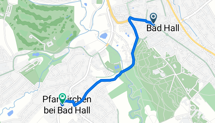
Cycling Route in Bad Hall, Upper Austria, Austria

Bad Hall - Pfarrkirchen bei Bad Hall (Ortszentren, Umgehung von Hauptverkehrsstraßen)

0
Open this route in the Bikemap app

Open this route in the Bikemap app

Open this route in Bikemap Web

Open this route in Bikemap Web

1 km
Distance
39 m
Ascent
24 m
Descent
-:-- h
Duration
-- km/h
Avg. Speed
--- m
Max. Elevation

About This Route

Bei dieser Verbindung der Ortszentren fährt man zuerst Richtung Westen, biegt dann am Kirchenplatz auf die Kurhausstraße, hält sich nach der Therme Mediterrana eher rechts nimmt den geschotterten Weg, der am NW-Rand des Kurparks hinunter zum Sulzbach führt. Diesem folgt man weiter, über den Sulzbach hinweg, links an der alten Tassiloquelle vorbei, wobei man sich dann wieder rechts (Mayrbäurlweg) halten sollte, um den Hang hinauf (recht steil, aber vor allem mit E-Bike sicherlich problemlos machbar) und ans Ziel zu gelangen (Pfarr- und Gemeindeamt).

Dauer: etwa 5-10 Minuten

You will cycle on the following surfaces: Paved Gravel

Customize this cycling route with the Bikemap route planner.

Make it yours!

Did you know? You can use this route as a template in our cycling route planner if you don't wish to start from scratch. Customize it based on your needs to plan your perfect cycling tour.

Open it in the app