Premium Badge Download on the App Store Get it on Google Play Turn-by-turn Navigation Offline Maps Bike Type Optimized Routing Premium Maps Custom Bike Computer Export Routes Route Previews Fall Detection Premium Support

Cycling Route in Scharnstein, Upper Austria, Austria

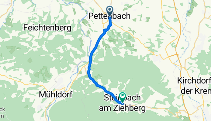
Pettenbach - Steinbach am Ziehberg (Ortszentren, Umgehung von Hauptverkehrsstraßen)

0
Open this route in the Bikemap app

Open this route in the Bikemap app

Open this route in Bikemap Web

Open this route in Bikemap Web

10 km
Distance
119 m
Ascent
53 m
Descent
-:-- h
Duration
-- km/h
Avg. Speed
--- m
Max. Elevation

About This Route

Vom Pettenbacher Zentrum führt der Weg zunächst Richtung Süden auf die Marktstraße, dann links auf die Kirchdorfer Straße und dann gleich wieder rechts auf die Dürndorfstraße an der Post und Sparkasse vorbei. Im Ort hält man sich an einer Kreuzung links, dann an der nächsten Abzweigung rechts, wonach es über Die Harrau und den Edlachweg über's Feld und Richtung B120 geht. Dort fährt man nach Süden Richtung Scharnstein auf die Bundesstraße auf und folgt dieser auf etwa 3 km, bis nach einer Kiesgrube ein Abzweig nach links kommt. Diese Nebenstraße führt nun nach Steinfelden und nach 1.5 km auf die Ziehberg Landstraße L553. Wenn man nun nach links auf diese einbiegt und etwa 4 km leicht bergauf folgt, hat man das Zentrum von Steinbach am Ziehberg erreicht, wo es neben Gemeindeamt und Kirche auch eine Einkaufsmöglichkeit gibt.

Dauer: 30-40 Minuten 

This cycling route is ideal for: Road bike City bike

You will cycle on the following surfaces: Paved

Customize this cycling route with the Bikemap route planner.

Make it yours!

Did you know? You can use this route as a template in our cycling route planner if you don't wish to start from scratch. Customize it based on your needs to plan your perfect cycling tour.

Open it in the app