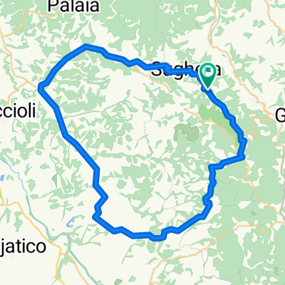
Cycling Route in Montaione, Tuscany, Italy
Montaione official trail #6
5

Open this route in the Bikemap app

Open this route in Bikemap Web
24
km
Distance
Distance
502
m
Ascent
Ascent
502
m
Descent
Descent
-:--
h
Duration
Duration
--
km/h
Avg. Speed
Avg. Speed
---
m
Max. Elevation
Max. Elevation