Premium Badge Download on the App Store Get it on Google Play Turn-by-turn Navigation Offline Maps Bike Type Optimized Routing Premium Maps Custom Bike Computer Export Routes Route Previews Fall Detection Premium Support

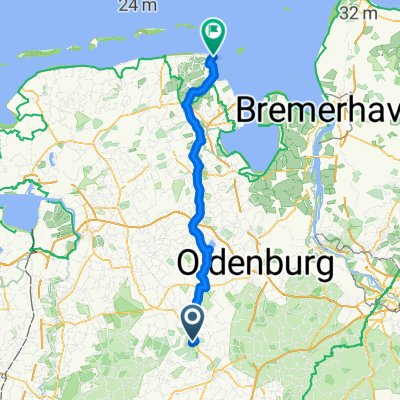
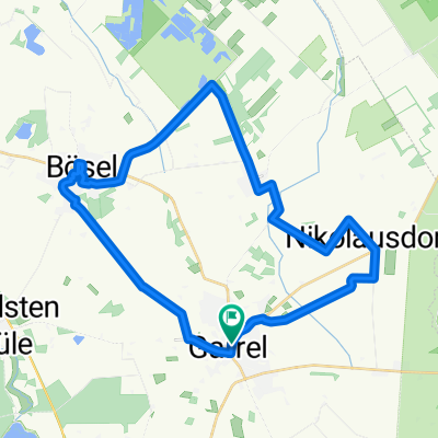
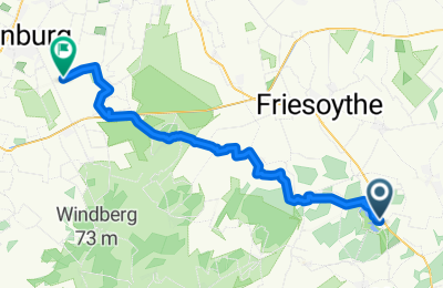
Cycling Route in Garrel, Lower Saxony, Germany

Thületour 3.Abschnitt

1
Open this route in the Bikemap app

Open this route in the Bikemap app

Open this route in Bikemap Web

Open this route in Bikemap Web

47 km
Distance
36 m
Ascent
51 m
Descent
-:-- h
Duration
-- km/h
Avg. Speed
29 m
Max. Elevation

About This Route

Von der Thülsfeder Talsperre zur Meyerwerft durch Wald und Moor und überdie Autoteststrecke Papenburg 

You will cycle on the following surfaces: Paved Unpaved Gravel

Customize this cycling route with the Bikemap route planner.

Make it yours!

Did you know? You can use this route as a template in our cycling route planner if you don't wish to start from scratch. Customize it based on your needs to plan your perfect cycling tour.

Open it in the app