Premium Badge Download on the App Store Get it on Google Play Turn-by-turn Navigation Offline Maps Bike Type Optimized Routing Premium Maps Custom Bike Computer Export Routes Route Previews Fall Detection Premium Support

Cycling Route in Berchtesgaden, Bavaria, Germany

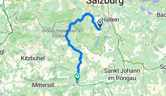
Etap 2 Berchtesgaden - Zell am See

0
Open this route in the Bikemap app

Open this route in the Bikemap app

Open this route in Bikemap Web

Open this route in Bikemap Web

87 km
Distance
514 m
Ascent
323 m
Descent
-:-- h
Duration
-- km/h
Avg. Speed
--- m
Max. Elevation

About This Route

Kierujemy się na miasteczko Bichowswisen. Kolejny raz jedziemy ścieżką rowerową Mozartradeweg. Po krótkim około 9 kilometrowym podjeździe dojeżdżamy do Bad Reichenhal, skąd wzdłuż rzeki Saallach, jedziemy ścieżką rowerowa w kierunku Zell am See. Asfaltowo/szutrowa ścieżka wiję się doliną i wiedzie przez słynne ośrodki narciarskie, miedzy innymi Lofer. Po wyjeździe mijamy dwutysięcznik Mitternhorn i jeszcze wyższy Birnhorn. Stąd do Zell am See zostaje około 20 kilometrów jazdy ścieżką o nieznacznym nachyleniu około 1-2 %. Dla grupy która będzie miała ochotę do zdobycia jest szczyt Schmittenhohe, na który prowadzi trasa rowerowa z centrum Zell am See

Customize this cycling route with the Bikemap route planner.

Make it yours!

Did you know? You can use this route as a template in our cycling route planner if you don't wish to start from scratch. Customize it based on your needs to plan your perfect cycling tour.

Open it in the app