Premium Badge Download on the App Store Get it on Google Play Turn-by-turn Navigation Offline Maps Bike Type Optimized Routing Premium Maps Custom Bike Computer Export Routes Route Previews Fall Detection Premium Support

Cycling Route in Sault, Provence-Alpes-C么te d'Azur Region, France

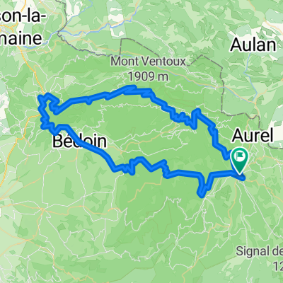
1. Sault - Mount Ventoux 1912 m - Sault

0
Open this route in the Bikemap app

Open this route in the Bikemap app

Open this route in Bikemap Web

Open this route in Bikemap Web

46 km
Distance
1302 m
Ascent
1204 m
Descent
-:-- h
Duration
-- km/h
Avg. Speed
--- m
Max. Elevation

About This Route

über Les Graygaux, Verdolier, Col des Tempetes, Mont Ventoux, col des Tempetes, Col de la Frache, Sault

Customize this cycling route with the Bikemap route planner.

Make it yours!

Did you know? You can use this route as a template in our cycling route planner if you don't wish to start from scratch. Customize it based on your needs to plan your perfect cycling tour.

Open it in the app