Premium Badge Download on the App Store Get it on Google Play Turn-by-turn Navigation Offline Maps Bike Type Optimized Routing Premium Maps Custom Bike Computer Export Routes Route Previews Fall Detection Premium Support

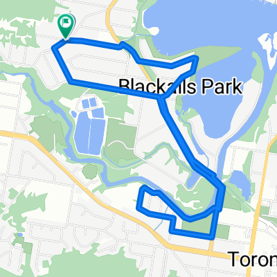
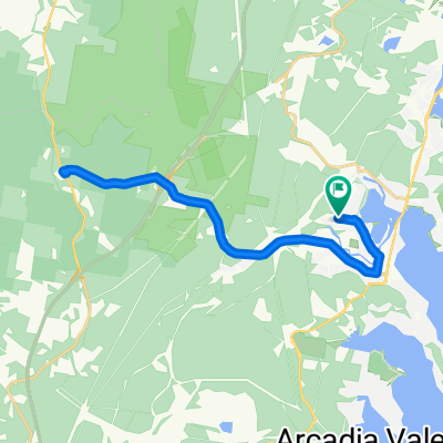
Cycling Route in Fennell Bay, New South Wales, Australia

Flat Ride Blackalls & Toronto

1
Open this route in the Bikemap app

Open this route in the Bikemap app

Open this route in Bikemap Web

Open this route in Bikemap Web

12 km
Distance
53 m
Ascent
60 m
Descent
-:-- h
Duration
-- km/h
Avg. Speed
--- m
Max. Elevation

About This Route

1. Leave Blackalls Park PS. Left into Rupert St. Left into South Parade. Exit with a right turn into Reynolds St (East End) and make your way to the Greenway-Cycleway.

2. Travel the Greenway-Cycleway for 425 metres SOUTH and exit EAST to Blackall Avenue and into Blackalls Park Community Park car-park. 

3. Cross the grassy area on the south side of the car-park and ride to the 'southern' waterfront trail. Go as far EAST as possible to the point on Stony Creek. Now, Turn and follow the 'northern' waterfront shoreline back west to the car park ... about 820 metres there and back.

4. Follow Bayview Avenue and Railway Parade North south-east. Go ENE on the laneway and bridge to cross  the creek into Venetia Avenue.

5. Follow Venetia Avenue all the way to the T-intersection with Lake Street then go LEFT into Lake and follow it all the way NNE to its end then come back to the Stony Creek Bridge.

6. After crossing Stony Creek, travel "south" the 410 metres to Thorne Street. Turn right into Thorne then Left into William Street then onto the laneway which leads you quickly to Awaba Road between the houses.

7. Once on Awaba Road travel WNW about 550 metres to Toronto High School back entrance then complete a U-turn and return about 365 metres to the narrow laneway that leads NORTH to Galbraith Avenue.

8. Follow Galbraith Avenue west then swing around the bend into Field Avenue and travel north along the front of the High School and join the park-land cycleway back to Cook Street.

9. Veer right on Cook and into James Street past the Workers Club, Repco, the Polyclinic and KFC.

10. At Cary Street turn north and head the 115 metres to the entry to the Fassifern Greenway-Cycleway back to home.

11. After crossing Stony Creek follow Railway Parade roughly NORTH-WEST to the corner of Centre Avenue (Liquor Store and Ocean Melody Chinese Restaurant).

12. Make a left turn into Centre Avenue.

13. Soon, a  quick VEER into Rhodes Street, left onto Charles Street and then home via a right turn to Rupert and a quick left turn into Todd.


Customize this cycling route with the Bikemap route planner.

Make it yours!

Did you know? You can use this route as a template in our cycling route planner if you don't wish to start from scratch. Customize it based on your needs to plan your perfect cycling tour.

Open it in the app