Premium Badge Download on the App Store Get it on Google Play Turn-by-turn Navigation Offline Maps Bike Type Optimized Routing Premium Maps Custom Bike Computer Export Routes Route Previews Fall Detection Premium Support

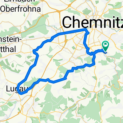
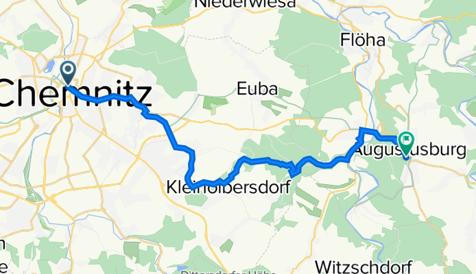
Cycling Route in Chemnitz, Saxony, Germany

von Chemnitz-City nach Augustusburg

4
Open this route in the Bikemap app

Open this route in the Bikemap app

Open this route in Bikemap Web

Open this route in Bikemap Web

18 km
Distance
484 m
Ascent
278 m
Descent
-:-- h
Duration
-- km/h
Avg. Speed
--- m
Max. Elevation

About This Route

beginnend im Stadtzentrum am Roten Turm die Augustusburger Straße (rechtsseitiger Radweg) stadtauswärts; weiter die Adelsbergstraße bis linksseitigem Abzweig Höhe Walter-Janka-Straße; ab dort kurzer steiler Anstieg hinauf ins Waldgebiet; Siedlung Kleinolbersdorf passieren; weiter auf Feldweg am Waldrand bis zum Adelsbergturm; weiter im Wald die Waldweg-/Schotterabfahrt bis hinunter ins Sternmühlental; über Bach rechtsseitig am Waldrand Richtung Erdmannsdorf; kurze Asphaltpassage bis nach der Brücke rechts wieder in den Wald der Einstieg hoch zur Burg vor dem Biker liegt; die linke Variante (so wie angegeben) ist die steilere/ kürzere/ herzfordernde Strecke :-)! Oben angekommen wartet ein "Kühles Blondes" in der Burggaststätte...

This cycling route is ideal for: MTB

You will cycle on the following surfaces: Paved Gravel

Customize this cycling route with the Bikemap route planner.

Make it yours!

Did you know? You can use this route as a template in our cycling route planner if you don't wish to start from scratch. Customize it based on your needs to plan your perfect cycling tour.

Open it in the app