Premium Badge Download on the App Store Get it on Google Play Turn-by-turn Navigation Offline Maps Bike Type Optimized Routing Premium Maps Custom Bike Computer Export Routes Route Previews Fall Detection Premium Support

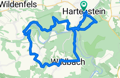
Cycling Route in Hartenstein, Saxony, Germany

Hartenstein - Fährbrücke - Langenbach - Wildbach

1
Open this route in the Bikemap app

Open this route in the Bikemap app

Open this route in Bikemap Web

Open this route in Bikemap Web

20 km
Distance
472 m
Ascent
472 m
Descent
-:-- h
Duration
-- km/h
Avg. Speed
--- m
Max. Elevation

About This Route

  • trail- und höhenmeterlastig
  • nicht zu schwer, aber nicht zu unterschätzen
  • Auf Mittelweg (zw. Hartenstein - Schwarzer Teich und Fährbrücke/Schönau) teilweise sehr schmal am Hang; Vorsicht: Baum liegt quer!

This cycling route is ideal for: MTB

You will cycle on the following surfaces: Paved Unpaved Gravel

Highlights Along The Route

Point of Interest

Hier beginnt das für mich schönste Teilstück: Feinster Wald- und Wiesentrail mit kleiner Bachdurchfahrt. Die volle Palette auf knapp 2km ;-)

Customize this cycling route with the Bikemap route planner.

Make it yours!

Did you know? You can use this route as a template in our cycling route planner if you don't wish to start from scratch. Customize it based on your needs to plan your perfect cycling tour.

Open it in the app