Premium Badge Download on the App Store Get it on Google Play Turn-by-turn Navigation Offline Maps Bike Type Optimized Routing Premium Maps Custom Bike Computer Export Routes Route Previews Fall Detection Premium Support

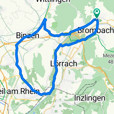
Cycling Route in Steinen, Baden-Württemberg, Germany

Steinen-Scheinberg-Maienberg-Schopfe- Steinen

1
Open this route in the Bikemap app

Open this route in the Bikemap app

Open this route in Bikemap Web

Open this route in Bikemap Web

28 km
Distance
605 m
Ascent
603 m
Descent
-:-- h
Duration
-- km/h
Avg. Speed
--- m
Max. Elevation

About This Route

Von Steinen geht es steil den Stutz hoch in den Wald rund um den Scheinberg (einige Anstiege und abfahrten)dann gelangen wir nach Langenau dort fahren wir in der Ortsmitte hoch richtung Maienberg(Anstieg) und umrunden diesen(vor Schopfheim vom Hauptweg links Trail dann 80 m rechts dann links Trail als alternative) und gelangen nach Schopfheim von dort noch einen anstieg hoch und über Langenau flach an der Wiese zurück nach Steinen

This cycling route is ideal for: MTB

You will cycle on the following surfaces: Unpaved Gravel

Customize this cycling route with the Bikemap route planner.

Make it yours!

Did you know? You can use this route as a template in our cycling route planner if you don't wish to start from scratch. Customize it based on your needs to plan your perfect cycling tour.

Open it in the app