Premium Badge Download on the App Store Get it on Google Play Turn-by-turn Navigation Offline Maps Bike Type Optimized Routing Premium Maps Custom Bike Computer Export Routes Route Previews Fall Detection Premium Support

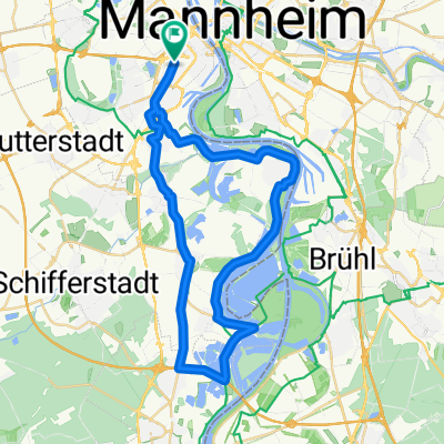
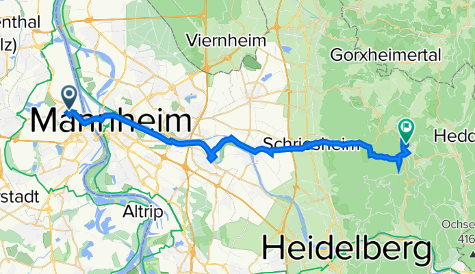
Cycling Route in Ludwigshafen am Rhein, Rhineland-Palatinate, Germany

friesenheim-wilhelmsfeld

0
Open this route in the Bikemap app

Open this route in the Bikemap app

Open this route in Bikemap Web

Open this route in Bikemap Web

31 km
Distance
454 m
Ascent
55 m
Descent
-:-- h
Duration
-- km/h
Avg. Speed
--- m
Max. Elevation

About This Route

aus friesenheim heraus radweg an der basf entlang - kurt-schumacher-brücke nach mannheim - luisenring - ab mvv-hochhaus/museumsschiff radweg am neckar entlang bis seckenheim - neckarbrücke nach ilvesheim - l542 bis ladenburg - durch die altstadt bis zur schriesheimer straße - links in radweg (schriesheimer fußweg) einbiegen - in schriesheim auf die talstraße nach wilhelmsfeld

ab schriesheim stetig ansteigend, nach dem schwimmbad teilweise recht anspruchsvoll, mit meinem stevens-8-gang-nabenschaltung-city-bike war ich an der grenze, konnte jedoch ohne abzusteigen hochfahren


nach einer wohlverdienten pause wieder nach lu zurück


This cycling route is ideal for: Road bike

You will cycle on the following surfaces: Paved

Customize this cycling route with the Bikemap route planner.

Make it yours!

Did you know? You can use this route as a template in our cycling route planner if you don't wish to start from scratch. Customize it based on your needs to plan your perfect cycling tour.

Open it in the app