Premium Badge Download on the App Store Get it on Google Play Turn-by-turn Navigation Offline Maps Bike Type Optimized Routing Premium Maps Custom Bike Computer Export Routes Route Previews Fall Detection Premium Support

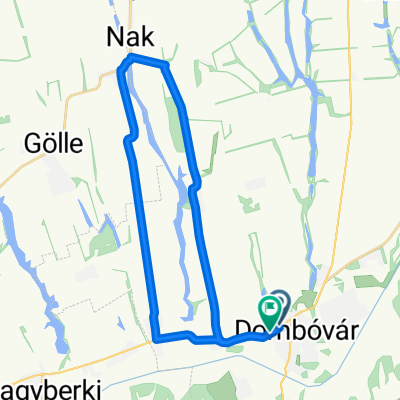
Cycling Route in Dombóvár, Tolna megye, Hungary

Szőlőhegy - Nyerges / a tetőn át.

1
Open this route in the Bikemap app

Open this route in the Bikemap app

Open this route in Bikemap Web

Open this route in Bikemap Web

11 km
Distance
214 m
Ascent
221 m
Descent
-:-- h
Duration
-- km/h
Avg. Speed
--- m
Max. Elevation

About This Route

MTB vagy Cross trekking kerékpárral.  Zömmel aszfalt út, de a dombetőn át vezető út burkolata földes, kavicsos, füves, változatos talaj.  A dombtető eléréséhez kb 4-5% emelkedöt kell megmászni (80m szint) ill a domb másik oldalán legurúlni. Az útvonal érinti a Nyerges Parkerdőnél lévő tavat. Megj: A tó aszfaltozott sík úton is megközelithető.

This cycling route is ideal for: MTB

You will cycle on the following surfaces: Paved Unpaved Gravel

Customize this cycling route with the Bikemap route planner.

Make it yours!

Did you know? You can use this route as a template in our cycling route planner if you don't wish to start from scratch. Customize it based on your needs to plan your perfect cycling tour.

Open it in the app