

Talsperre Bautzen Rundan
A cycling route starting in Bautzen, Saxony, Germany.
Overview
About this route
Round around the Bautzen dam and into the Bautzen highland, mainly through the forest on the highways of the timber industry.
Start: Parking lot at Humboldt-Hain in Bautzen, west exit from BOMBARIER.
- -:--
- Duration
- 61.4 km
- Distance
- 669 m
- Ascent
- 669 m
- Descent
- ---
- Avg. speed
- ---
- Max. altitude

Route quality
Waytypes & surfaces along the route
Waytypes
Track
20.9 km
(34 %)
Quiet road
14.1 km
(23 %)
Surfaces
Paved
30.1 km
(49 %)
Unpaved
23.3 km
(38 %)
Asphalt
27.6 km
(45 %)
Gravel
10.4 km
(17 %)
Route highlights
Points of interest along the route
Point of interest after 6.9 km
Ab hier Trail am Feldrand
Point of interest after 7.6 km
Provisorische Bachbrücke aus Eisenbahnschienen und Stahlplatten, evtl. Bike tragen.
Point of interest after 21.6 km
Naturpark Bautzen: Tunnel mit Trail & Bach unter der Bahnlinie, kann je nach Jahreszeit und Niederschlagsmenge in den Vortagen feucht sein.
Point of interest after 50.1 km
Steiler Uphill auf den Mönchswalder Berg, etwa 500 m / 100 Hm
Accommodation after 50.8 km
Mönchswalder Berg
Continue with Bikemap
Use, edit, or download this cycling route
You would like to ride Talsperre Bautzen Rundan or customize it for your own trip? Here is what you can do with this Bikemap route:
Free features
- Save this route as favorite or in collections
- Copy & plan your own version of this route
- Sync your route with Garmin or Wahoo
Premium features
Free trial for 3 days, or one-time payment. More about Bikemap Premium.
- Navigate this route on iOS & Android
- Export a GPX / KML file of this route
- Create your custom printout (try it for free)
- Download this route for offline navigation
Discover more Premium features.
Get Bikemap PremiumFrom our community
Other popular routes starting in Bautzen
 Talsperre Bautzen Rundan
- Distance
- 61.4 km
- Ascent
- 669 m
- Descent
- 669 m
- Location
- Bautzen, Saxony, Germany
 Bautzen - Kühlhaus Görlitz
- Distance
- 46.4 km
- Ascent
- 261 m
- Descent
- 260 m
- Location
- Bautzen, Saxony, Germany
 Bautzen - Jakubzburg
- Distance
- 24.7 km
- Ascent
- 261 m
- Descent
- 326 m
- Location
- Bautzen, Saxony, Germany
 Bautzen - Wilthen - Stolpen - Leppersdorf
- Distance
- 79 km
- Ascent
- 438 m
- Descent
- 378 m
- Location
- Bautzen, Saxony, Germany
 Mit Sachsenpower um die Talsperre Bautzen
- Distance
- 33 km
- Ascent
- 265 m
- Descent
- 252 m
- Location
- Bautzen, Saxony, Germany
 Karl-Liebknecht-Straße 14, Bautzen nach Karl-Liebknecht-Straße 14, Bautzen
- Distance
- 55 km
- Ascent
- 563 m
- Descent
- 567 m
- Location
- Bautzen, Saxony, Germany
 Spreeradweg Teil 2
- Distance
- 102.9 km
- Ascent
- 233 m
- Descent
- 379 m
- Location
- Bautzen, Saxony, Germany
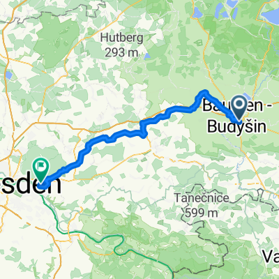 Von Bautzen bis Dresden
- Distance
- 67.6 km
- Ascent
- 590 m
- Descent
- 566 m
- Location
- Bautzen, Saxony, Germany
Open it in the app