Premium Badge Download on the App Store Get it on Google Play Turn-by-turn Navigation Offline Maps Bike Type Optimized Routing Premium Maps Custom Bike Computer Export Routes Route Previews Fall Detection Premium Support

Cycling Route in Münchenstein, Basel-Landschaft, Switzerland
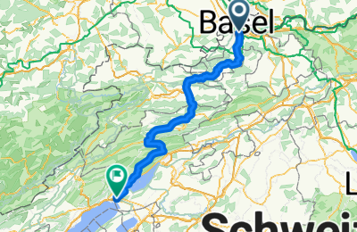
Basel - Thielle

1
Open this route in the Bikemap app

Open this route in the Bikemap app

Open this route in Bikemap Web

Open this route in Bikemap Web

109 km
Distance
989 m
Ascent
846 m
Descent
-:-- h
Duration
-- km/h
Avg. Speed
--- m
Max. Elevation

About This Route

Von Base nach Thielle (Gampelen) über

  • Delémont
  • Moutier
  • Tavannes
  • Lamboing

Die Steigung vor Champoz (nach Moutier) ist beachtlich und beträgt bis zu 15%. Die Landschaft auf dem Plateau ist aber sehr schön. Wer kräfte sparen will, kann auch diesen Berg weglassen und auf der Hauptstrasse bleiben.

This cycling route is ideal for: Road bike

You will cycle on the following surfaces: Paved

Customize this cycling route with the Bikemap route planner.

Make it yours!

Did you know? You can use this route as a template in our cycling route planner if you don't wish to start from scratch. Customize it based on your needs to plan your perfect cycling tour.

Open it in the app