Premium Badge Download on the App Store Get it on Google Play Turn-by-turn Navigation Offline Maps Bike Type Optimized Routing Premium Maps Custom Bike Computer Export Routes Route Previews Fall Detection Premium Support

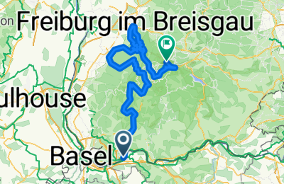
Cycling Route in Rheinfelden, Canton of Aargau, Switzerland

Rheinfelden - Feldberg

0
Open this route in the Bikemap app

Open this route in the Bikemap app

Open this route in Bikemap Web

Open this route in Bikemap Web

157 km
Distance
4039 m
Ascent
3521 m
Descent
-:-- h
Duration
-- km/h
Avg. Speed
1058 m
Max. Elevation

About This Route

Quer durch den Hochschwarzwald, u. a. der Schauinsland oder dem Feldberg als Bergankunft.

You will cycle on the following surfaces: Paved

Customize this cycling route with the Bikemap route planner.

Make it yours!

Did you know? You can use this route as a template in our cycling route planner if you don't wish to start from scratch. Customize it based on your needs to plan your perfect cycling tour.

Open it in the app