Premium Badge Download on the App Store Get it on Google Play Turn-by-turn Navigation Offline Maps Bike Type Optimized Routing Premium Maps Custom Bike Computer Export Routes Route Previews Fall Detection Premium Support

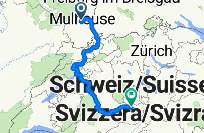
Cycling Route in Mulhouse, Alsace-Champagne-Ardenne-Lorraine, France

Mulhouse-Meiringen easy

0
Open this route in the Bikemap app

Open this route in the Bikemap app

Open this route in Bikemap Web

Open this route in Bikemap Web

255 km
Distance
2769 m
Ascent
2417 m
Descent
-:-- h
Duration
-- km/h
Avg. Speed
--- m
Max. Elevation

About This Route

Itinéraire via Spiez et la rive Sud du Thunersee, et le bord du Brienzersee

Customize this cycling route with the Bikemap route planner.

Make it yours!

Did you know? You can use this route as a template in our cycling route planner if you don't wish to start from scratch. Customize it based on your needs to plan your perfect cycling tour.

Open it in the app