Premium Badge Download on the App Store Get it on Google Play Turn-by-turn Navigation Offline Maps Bike Type Optimized Routing Premium Maps Custom Bike Computer Export Routes Route Previews Fall Detection Premium Support

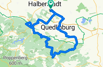
Cycling Route in Harsleben, Saxony-Anhalt, Germany

Harsleben - Selketal - Ramberg - Blankenburg

0
Open this route in the Bikemap app

Open this route in the Bikemap app

Open this route in Bikemap Web

Open this route in Bikemap Web

115 km
Distance
645 m
Ascent
645 m
Descent
-:-- h
Duration
-- km/h
Avg. Speed
--- m
Max. Elevation

About This Route

Von Harsleben geht es Richtung Ditfurt nach Quedlinburg. Weiter führt der Weg nach Meisdorf über Gerstunger Burg und Radisleben. Dem Selketal folgen wir bis Alexisbad, das Friedenstal hinauf bis Abzweig zum Krebsbachtal zum Bremer Teich. Richtung Thale führt der Weg unterhalb des Ramberg das Wurmbachtal hinunter durch Stecklenberg. Vom Ortsteil Benneckenrode gelangen wir über Wienrode nach Blankenburg. Über Börnicke, Westerhausen, dem Steiholz und den Heidbergen gelangen wir zum Ausgangspunkt.

This cycling route is ideal for: MTB

You will cycle on the following surfaces: Paved Unpaved Gravel

Customize this cycling route with the Bikemap route planner.

Make it yours!

Did you know? You can use this route as a template in our cycling route planner if you don't wish to start from scratch. Customize it based on your needs to plan your perfect cycling tour.

Open it in the app