Premium Badge Download on the App Store Get it on Google Play Turn-by-turn Navigation Offline Maps Bike Type Optimized Routing Premium Maps Custom Bike Computer Export Routes Route Previews Fall Detection Premium Support

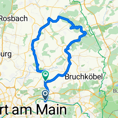
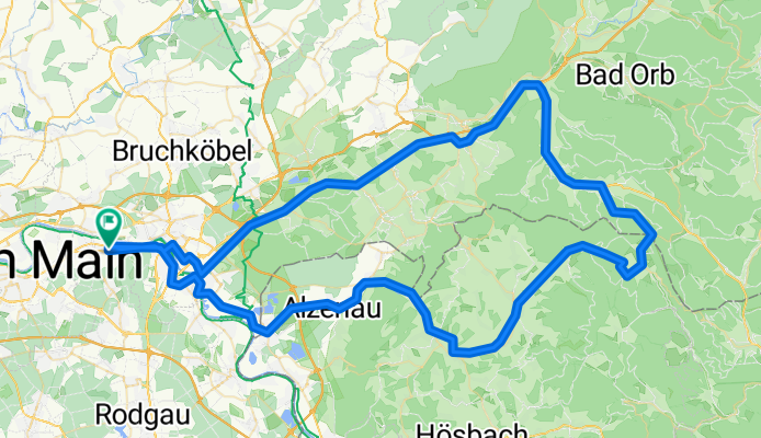
Cycling Route in Mühlheim am Main, Hesse, Germany

Mhm Wiesen Möm Alb Rod Mhm

0
Open this route in the Bikemap app

Open this route in the Bikemap app

Open this route in Bikemap Web

Open this route in Bikemap Web

114 km
Distance
904 m
Ascent
884 m
Descent
-:-- h
Duration
-- km/h
Avg. Speed
487 m
Max. Elevation

About This Route

Anfangs flach, ab Neuwirtheim langsam ansteigend, stärkere Steigung zwischen Bieber und Wiesen. Kurz vor Wiesen links am Hang der "BERGHOF" fast wie ein Schwarzwaldhaus gebaut, tolle Speisen. Hinter Wiesen wunderschöne Abfahrt Richtung Schöllkrippen. Von dort aus R4 Radweg folgen bis Mömbris Niedersteinbach. Von dort aus auf der Strasse bis zu den Dörsthöfen. Hier kann man sich nochmals stärken. Reststrecke über Albstadt mit leichter Steigung hinter Albstadt. Von Rodenbach sind es dann nochmal ca. 17 km bis Mühlheim

You will cycle on the following surfaces: Paved Unpaved

Customize this cycling route with the Bikemap route planner.

Make it yours!

Did you know? You can use this route as a template in our cycling route planner if you don't wish to start from scratch. Customize it based on your needs to plan your perfect cycling tour.

Open it in the app