Premium Badge Download on the App Store Get it on Google Play Turn-by-turn Navigation Offline Maps Bike Type Optimized Routing Premium Maps Custom Bike Computer Export Routes Route Previews Fall Detection Premium Support

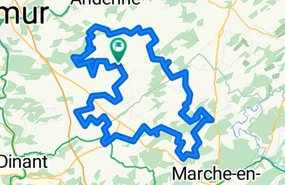
Cycling Route in Gesves, Wallonia, Belgium

SENTIERS D'ART - 141 km - Ciney, Gesves, Hamois, Havelange, Ohey et Somme-Leuze

0
Open this route in the Bikemap app

Open this route in the Bikemap app

Open this route in Bikemap Web

Open this route in Bikemap Web

133 km
Distance
2473 m
Ascent
2472 m
Descent
-:-- h
Duration
-- km/h
Avg. Speed
--- m
Max. Elevation

About This Route

Statistiques calculées à partir des données importées Distance : 141,4 km Altitude minimale : 162 m Altitude maximale : 335 m Dénivelé positif cumulé : 1587 m Dénivelé négatif cumulé : 1586 m

Customize this cycling route with the Bikemap route planner.

Make it yours!

Did you know? You can use this route as a template in our cycling route planner if you don't wish to start from scratch. Customize it based on your needs to plan your perfect cycling tour.

Open it in the app