Premium Badge Download on the App Store Get it on Google Play Turn-by-turn Navigation Offline Maps Bike Type Optimized Routing Premium Maps Custom Bike Computer Export Routes Route Previews Fall Detection Premium Support

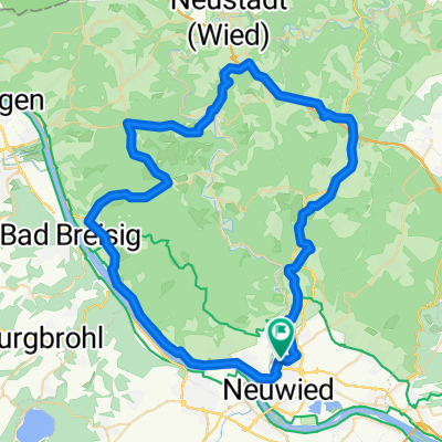
Cycling Route in Neuwied, Rhineland-Palatinate, Germany

MTB: Knackige Rhein-Wied-Berg+Hütten-Runde 38 km

0
Open this route in the Bikemap app

Open this route in the Bikemap app

Open this route in Bikemap Web

Open this route in Bikemap Web

36 km
Distance
1304 m
Ascent
1394 m
Descent
-:-- h
Duration
-- km/h
Avg. Speed
358 m
Max. Elevation

About This Route

Stationen:

Niederbieber Kirche, Römer-Kastell,

Kümmelberg, Ruine Kreuzkirche, Melsbach, Grillhütte,

Rengsdorf, Schauinslandhütte: Panorama !!

über Melsbach steile Wald-Abfahrt zur Laubachsmühle, Anstieg zum Meinhof, Waldstrecke zur Lauseich-Hütte,

Monrepos,dickster Nadelbaum im Kreis: Mammutbaum, Mammut, Panorama,

Waldstrecke über Jägerstuhlhütte, Christianshütte, Kappelhütte zur Brombeerschänke, Panorama !!

Edmundhütte Panorama, Weinbergschaukel !

sehr schöner Weinbergweg (Schützenweg),

Campingplatz Leutesd. Rheinstr., Biergarten Ley'scher Hof, Feldkirchen, Aussichtspunkt Lindenbäumchen ! Fliegerberg, Rodenbach, Niederbieber.

Strecke für Tekkingräder teilweise kritisch.


Customize this cycling route with the Bikemap route planner.

Make it yours!

Did you know? You can use this route as a template in our cycling route planner if you don't wish to start from scratch. Customize it based on your needs to plan your perfect cycling tour.

Open it in the app