

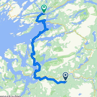
Overhalla - Kolvereid
A cycling route starting in Ranemsletta, Nord-Trøndelag Fylke, Norway.
Overview
About this route
- -:--
- Duration
- 120.3 km
- Distance
- 507 m
- Ascent
- 447 m
- Descent
- ---
- Avg. speed
- ---
- Avg. speed

Continue with Bikemap
Use, edit, or download this cycling route
You would like to ride Overhalla - Kolvereid or customize it for your own trip? Here is what you can do with this Bikemap route:
Free features
- Save this route as favorite or in collections
- Copy & plan your own version of this route
- Sync your route with Garmin or Wahoo
Premium features
Free trial for 3 days, or one-time payment. More about Bikemap Premium.
- Navigate this route on iOS & Android
- Export a GPX / KML file of this route
- Create your custom printout (try it for free)
- Download this route for offline navigation
Discover more Premium features.
Get Bikemap PremiumFrom our community
Other popular routes starting in Ranemsletta
 Overhalla - Kolvereid
- Distance
- 120.3 km
- Ascent
- 507 m
- Descent
- 447 m
- Location
- Ranemsletta, Nord-Trøndelag Fylke, Norway
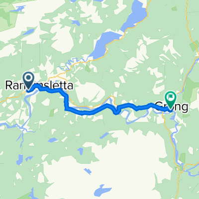 Skei, Overhalla to Medjåvegen 45–55, Grong
- Distance
- 24 km
- Ascent
- 307 m
- Descent
- 300 m
- Location
- Ranemsletta, Nord-Trøndelag Fylke, Norway
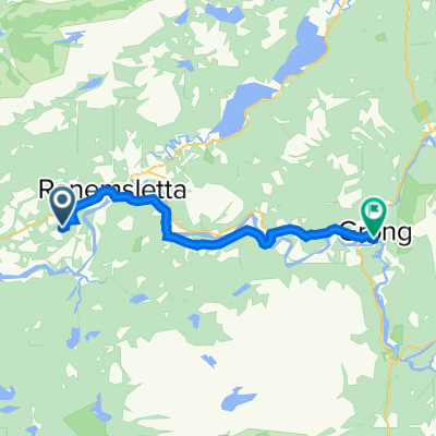 Tetlivegen 142–164, Skage i Namdalen to Medjåvegen 45–55, Grong
- Distance
- 27.2 km
- Ascent
- 310 m
- Descent
- 341 m
- Location
- Ranemsletta, Nord-Trøndelag Fylke, Norway
Open it in the app