Premium Badge Download on the App Store Get it on Google Play Turn-by-turn Navigation Offline Maps Bike Type Optimized Routing Premium Maps Custom Bike Computer Export Routes Route Previews Fall Detection Premium Support

Cycling Route in Conegliano, Veneto, Italy

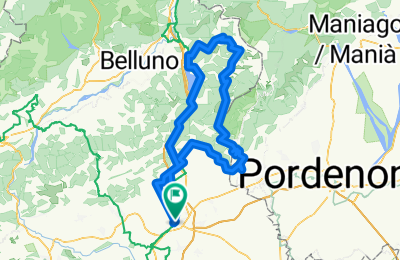
Conegliano-Alpago-Conegliano

0
Open this route in the Bikemap app

Open this route in the Bikemap app

Open this route in Bikemap Web

Open this route in Bikemap Web

130 km
Distance
1932 m
Ascent
1932 m
Descent
-:-- h
Duration
-- km/h
Avg. Speed
--- m
Max. Elevation

About This Route

Partenza dal centro storico di Conegliano; cappuccio in centro storico prima di partire; avvicinamento alla piana del Cansiglio attraverso i colli di Vittorio Veneto e Fregona; salita per la sterda di interesse storico "dei Carbonai", pausa panino alla Malga agriturismo "Pian del Cansiglio", discesa verso l'Alpago con saliscendi fino a Pieve d'Alpago, quindi il ritorno per il Lago di Santa Croce e Fadalto. 5-6 ore in bici assicurate.

This cycling route is ideal for: Road bike

You will cycle on the following surfaces: Paved

Customize this cycling route with the Bikemap route planner.

Make it yours!

Did you know? You can use this route as a template in our cycling route planner if you don't wish to start from scratch. Customize it based on your needs to plan your perfect cycling tour.

Open it in the app